In early January 2024, my husband and I visited Barcelona. We spent a few days in Barcelona and then rented a car. The goal was to find some waterfalls in Catalunya and the Pyrenees. Some of our thoughts seemed to be flipped. We thought driving in and around Barcelona might be difficult, but that wasn’t the case. The roads were great and the drivers weren’t wild. I thought there might be some waterfalls flowing during the winter months, but that wasn’t the case. In January 2024, Catalunya and Barcelona had been experiencing rather severe drought conditions.
I skipped one waterfall, Salt d’Aigua de La Foradada near the villages/towns of L’Esquirol and Cantonigròs, because Google Map reviews indicated that the water level was low there. We wanted to do some hiking, though, and decided on Salt de Sallent in Rupit. Rupit is a fascinating village that has a medieval appearance, partly because some of the buildings are from those times. The hike to the falls is around 2 miles round-trip and passes through the village, so we figured we’d at least get to see something! It had rained somewhat during the night, so I figured that there would be some water flowing, and that was at least true to a small extent.
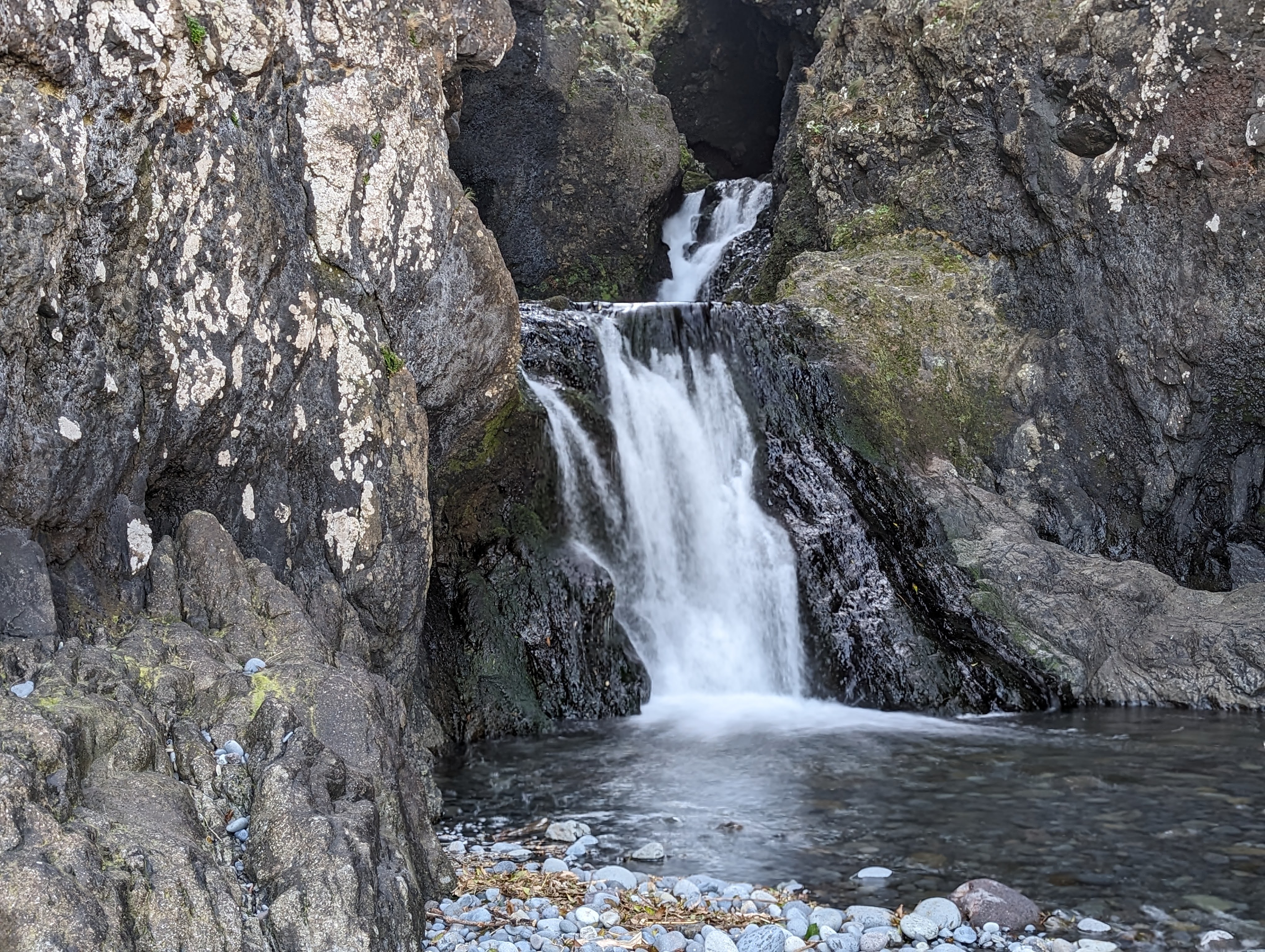
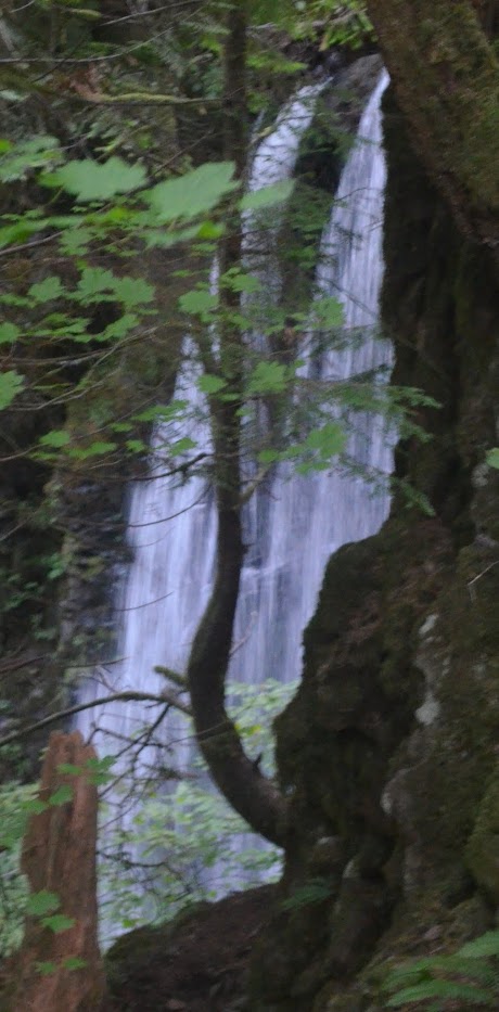
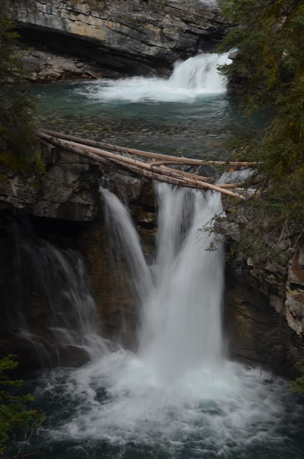
Upstream, another smaller waterfall, Salt de la Riera de Rupit, had more water flowing. I’ll discuss that in another post, I’ve decided. Salt de Sallent is the main attraction at 100 meters/330 feet in height. Not as much water was flowing, so I’ve included a video instead of a photo to give a better sense of the water that WAS flowing there. The height of the falls can be difficult to gauge when little water is flowing. When more water is flowing, Salt de Sallent would be a top destination. The hike through the village was definitely worth it, and the trail along the river is beautiful.
Directions:
- Head to Rupit. The roads are nice, but are winding and narrow so it will take some time even if the distance is short.
- From what I understand, the parking situation has changed. You cannot, and were likely never able to, drive on the main roads in the village. You should head toward the parking area before you “enter” the village. The parking area has an “address” of Plaça Era Nova, 7, 08569 Rupit.
- From the parking area, you want to cross the Rupit River so you’re on the east side of the river. From the parking area, there was a swinging bridge (Pont Penjat) that will get you to the east side.
- Follow the signs in the village to the falls. You’ll head downhill through the village for a bit, and then veer right to follow the river. It didn’t feel likely a terribly long hike.
Accessibility: 6/10 (moderate)
Height: 330′
Length of Hike: 2-miles round-trip
Where in the World is Salt de Sallent – Rupit?