
Ecola Falls is the the third waterfall above Multnomah Falls. Dutchman Falls and Weisendanger Falls are the other two falls. The hike is one of the more strenuous hikes I’ve ever done, even though it’s not terribly long.
Consider that Multnomah Falls is 620′ tall. To get upstream of Multnomah Falls, you’ve got to traverse that height. I’m no rock climber, so there’s definitely a way to get to the falls, but it’s 620′ over a short 1 mile (if that much). I attempted it in 2009 when I first visited the Columbia River Gorge, and gave up about 2/3 of the way up. I had already visited many other waterfalls that day and was too worn out. In 2015, I attempted the hike again and succeeded.
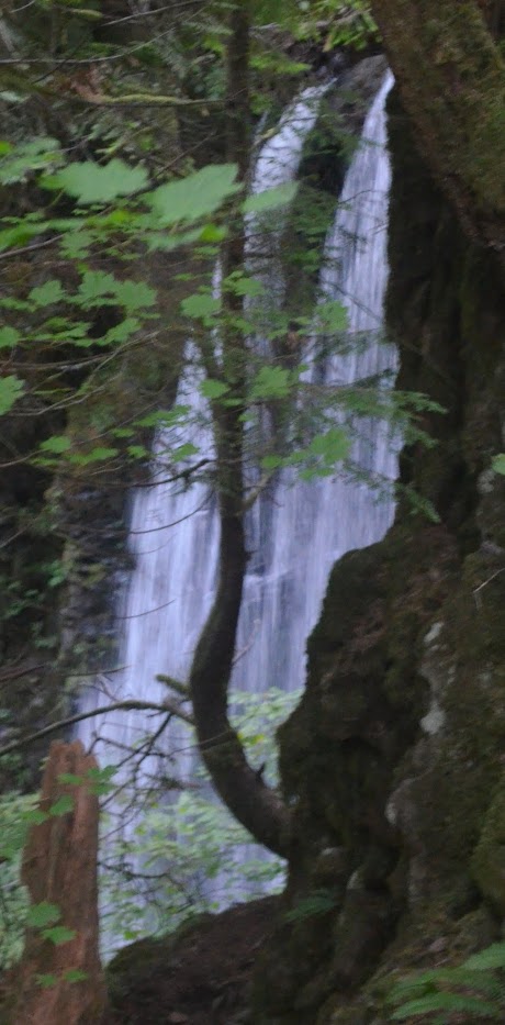
Once you get past that portion of the hike, it’s not a terrible additional portion of the hike (that I remember). There is still some uphill climb, but not as much as getting to the crest of the falls. To get to Ecola Falls and back down, it’s about 2.8 miles round-trip. Ecola Falls is the hardest to view as it is blocked by many trees. So I would probably turn around before reaching Ecola Falls unless I really wanted to add this to a waterfall list (like I did).
I know there were some wildfires in the Columbia River Gorge in 2017, very close to Multnomah Falls, that closed some access to the falls for a period of time. That is now open. But it is still an extremely visited waterfall, and from the US Forest Service website, there is now a reservation system for the summer months. I would include a link, but often the links expire, and it wasn’t difficult to find information the reservation system.
Directions:
- Take the exit off of I-84 toward the Columbia River Gorge Scenic Trail, and follow the road. It’s pretty hard to miss Multnomah Falls. The parking for the falls is actually right in the middle of the road.
- From the parking area, start heading toward the bridge that crosses Multnomah Creek. This is a uphill climb to begin.
- After crossing the bridge, you’ll have a 1 mile uphill hike. This is the part that’s tough. Once you reach switchback 9, you’ll head downhill.
- After reaching that switchback and heading downhill, you’ll reach a split. If you head right (indicated by a sign), you’ll reach the Multnomah Falls upper viewpoint. If you head left along trail 441, that will lead toward Weisendanger Falls. Even if you miss this first left, there’s a left later on.
- It’s about 0.4 miles further from the switchback to Weisendanger Falls. If you continue uphill beyond that, you’ll reach Ecola Falls.
Accessibility: 2/10 (strenuous)
Height: 55′
Length of Hike: 2.8 miles round-trip
Where in the World is Ecola Falls?

Leave a comment