

Quick Facts
Accessibility: 4/10 (moderate/strenous)
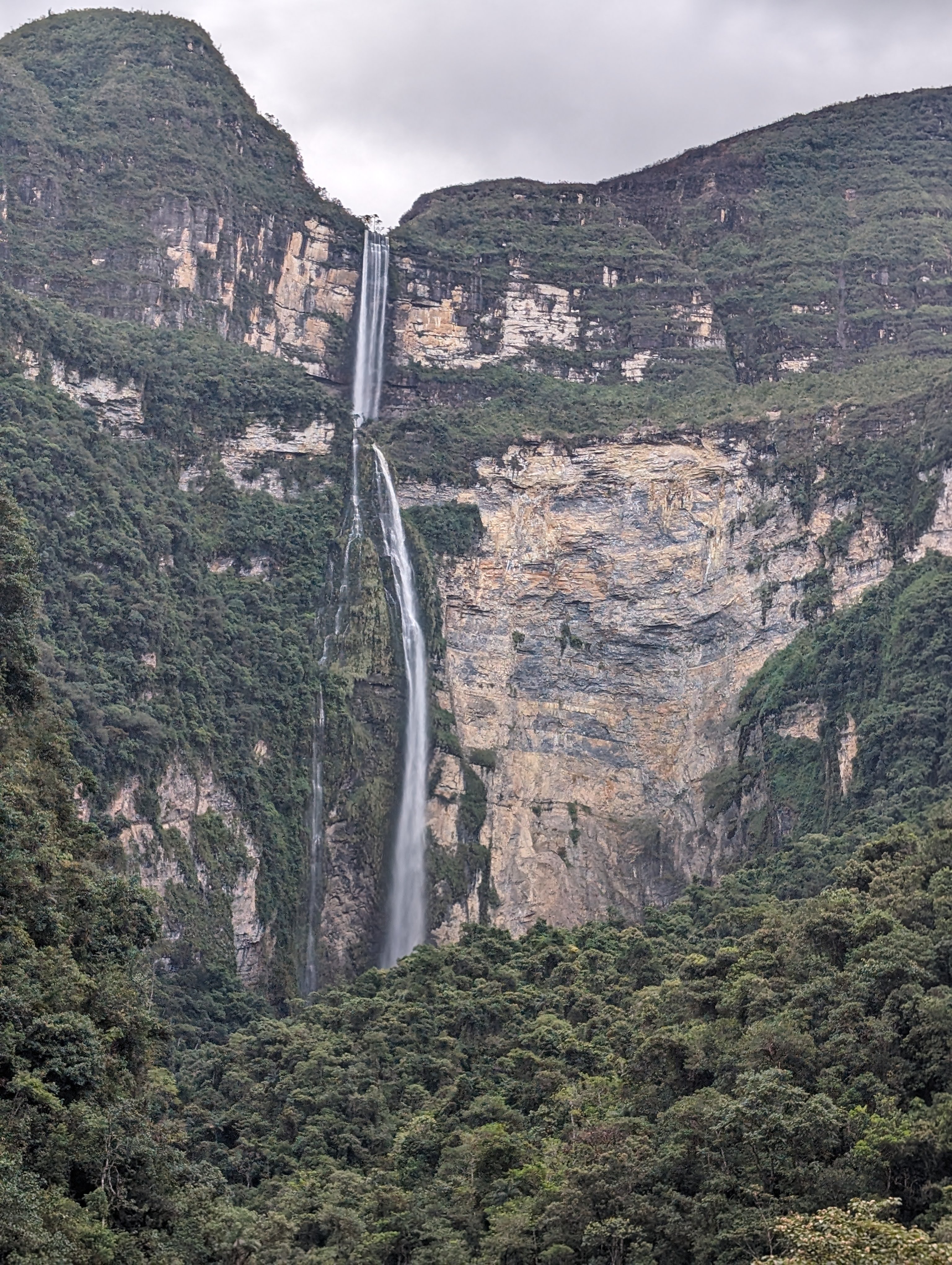
Height: 2530′ / 771 meters
Length of Hike: 7.7-miles / 12.4 km round-trip (from Cocachimba)
The Record
Once I knew my husband and I were headed to Perú, I started looking for waterfalls. We were headed to Lima, Cusco, and Machu Picchu, and there are waterfalls in each of those regions. But one of the falls that popped up was Gocta Falls. It’s very fuzzy about how the “tallest” waterfalls are determined, but Gocta Falls popped out for having a height of 2,530 feet, which definitely puts in the upper echelon of tall waterfalls. There are two separate sections, which is what complicates the decision about where to rank it. Cataratas las Tres Hermanas (~3000 feet) and Catarata Yumbilla (2938 feet) are both taller, but have even more sections. The falls at Yumbilla are pretty close to Gocta Falls, but I didn’t explore how to get there. I would say that you could spend weeks in the area around Gocta Falls finding waterfalls.
Getting to Gocta Falls is the tricky part. The falls were “hidden” until the beginning of this millennium. The Spaniard conquistadors and priests convinced the local people that there were “white-haired” mermaids at the base of the falls that would curse them. The Spaniards did this by making a few locals disappear, and to convince the locals that they should give up their beliefs and buy into Catholicism. As one website points out, the falls are clearly visible from some towns, so they’re not really hidden. They weren’t advertised until recently. The closest “major” city that has an airport with flights (as of 2024) is Chachapoyas, which is about an hour drive away. There are 3-4 flights per week on ATSA Airlines, and the flights are consistently delayed. (We know from experience.) There is an airport in Jaén, about 3 hours away, but flights have been suspended since the beginning of 2024…Other airports in Tarapoto, Chiclayo, and Cajamarca require drives or bus rides of 8 hours or so.
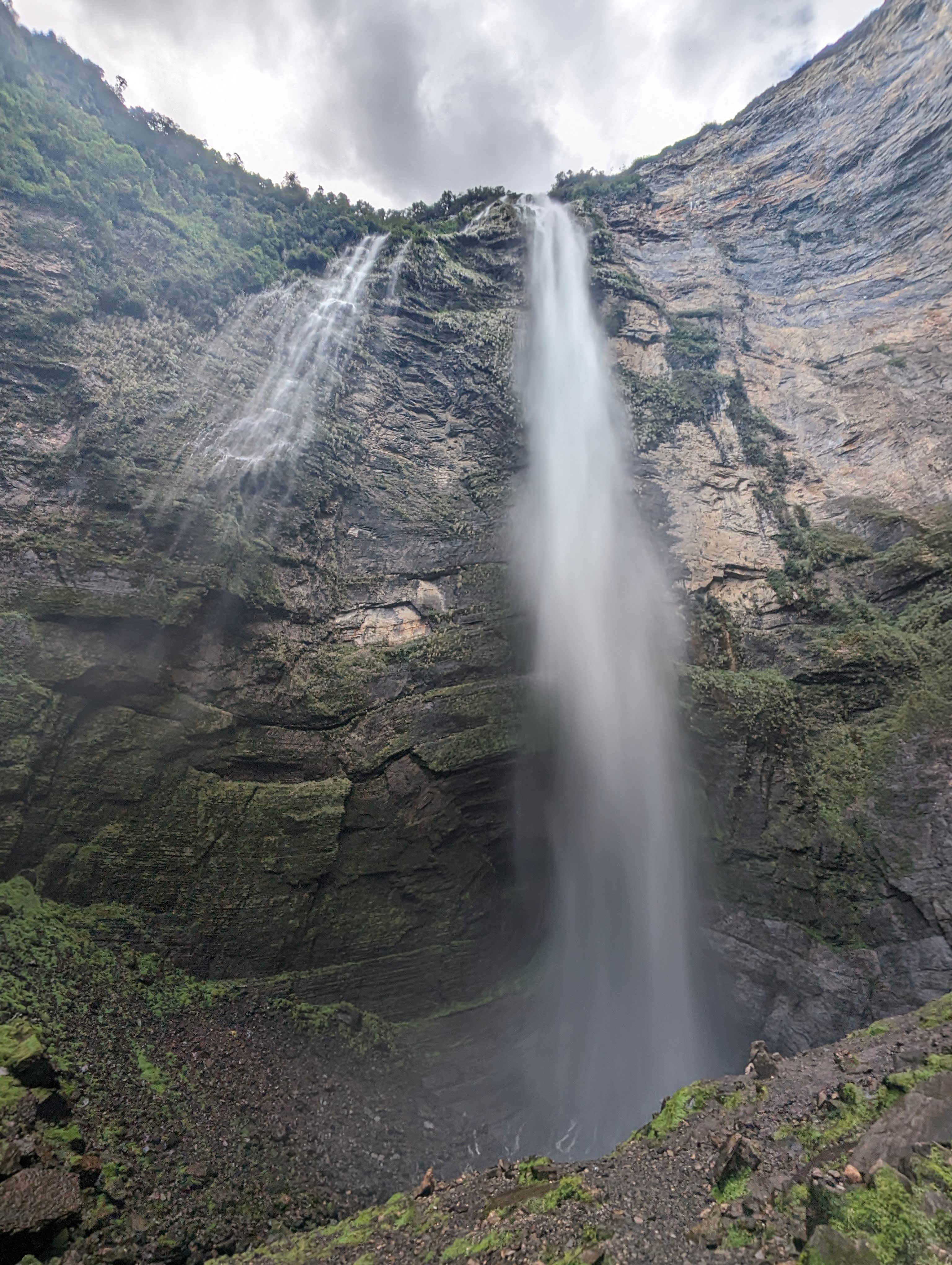
We flew into Chachapoyas, took a day to acclimate to the elevation of about ~7600′, visited some other sites, and then went on a guided tour to Gocta Falls. A guide, or at least transportation to start of the hike can be very useful. Construction was occurring on the road to Cocachimba, and the road was only open in certain 15 minute increments during the day. The trail from Cocachimba leads to the base of the second, larger drop. It’s a 4 mile hike one-way and there are elevation changes, though it’s not consistently uphill or downhill. I’m not sure if that’s a good or bad thing, but we were definitely worn out by the end, though we definitely enjoyed viewing the falls from the base. It was absolutely worth it! Compared to some other long hikes I’ve done, there were stops along the way for bathrooms and snacks/drinks, which made it seem less daunting.
I decided this was a good time to visit partly because we were headed to Perú already but also because May is the start of this area’s (Amazonas region) dry season. There’s still some rain but it’s less so than in the timeframe of October-April. The falls might have more water in those times, but it can also mean the roads are more difficult to traverse.
Directions
- Get to Chachapoyas and find a tour guide. I would recommend Tour Calandria’s and Kuelap Adventure. We used both of them.

Leave a comment