
Quick Facts
Accessibility: 9/10 (easy)
Height: 66′ / 20 m
Length of Hike: 1 mile / 1.6 km round-trip
The Record
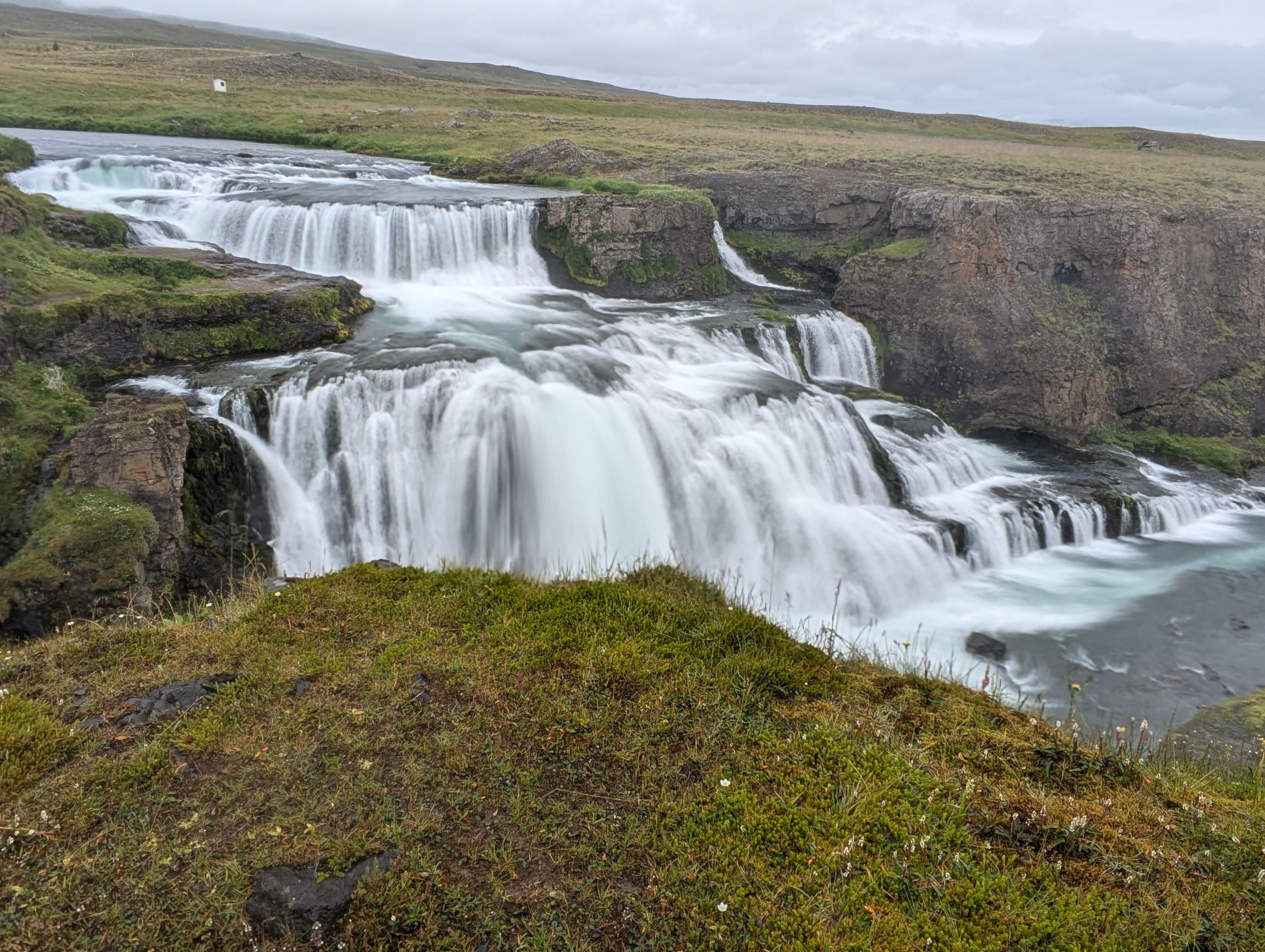
The cascading beauty of Iceland never ceases to amaze, and Reykjafoss is no exception. However, finding your way there requires a bit of local knowledge. Rather than simply typing the waterfall’s name into your GPS, it is best to set your destination specifically for the Reykjafoss Car Park. Here, you’ll pay a small parking fee before setting off on the trail. At the start of the walk, the falls appear as a modest feature in the distance, but as you approach, the true scale of the site begins to reveal itself. The sheer volume of water and the massive size of the drop become increasingly impressive with every step you take toward the riverbank.
Once you arrive at the falls, the experience is remarkably raw and open, featuring multiple unfenced viewpoints that allow for unobstructed photography and a real sense of connection with the landscape. You’ll get a fantastic perspective of the water crashing down before you reach the bridge. Crossing the bridge is a must, as it offers a completely different vantage point of the falls’ power. Just beyond the bridge lies a hidden gem: a natural hot spring nestled right along the river’s edge. During our visit, two people were peacefully soaking in the warmth, seemingly indifferent to the chilly temperatures around them (until they got out).
Directions
- These directions are from Akureyri, the nearest larger city. Head West on Route 1 (Ring Road). You will stay on the Ring Road for the majority of the journey, enjoying the scenic mountain passes.
- Continue on Route 1 until you reach the small village of Varmahlíð. Do not stop here for the falls; continue south on the Ring Road for a very short distance (less than 1 km).
- Look for the turn-off for Route 752 (Skagafjarðarvegur) heading south. You will drive along this paved road for approximately 7 km (4.3 miles).
- Turn Left onto Route 753 (Vindheimavegur). Look for the sign for Vindheimar. This road will descend toward the river and cross two small bridges.
- Immediately after crossing the bridges, turn right onto the gravel road (Vindheimamelar).
- Follow this gravel road for about 0.5 km. You will see the designated parking area on your right. This is where you will find the payment station for the parking fee.

Leave a comment