
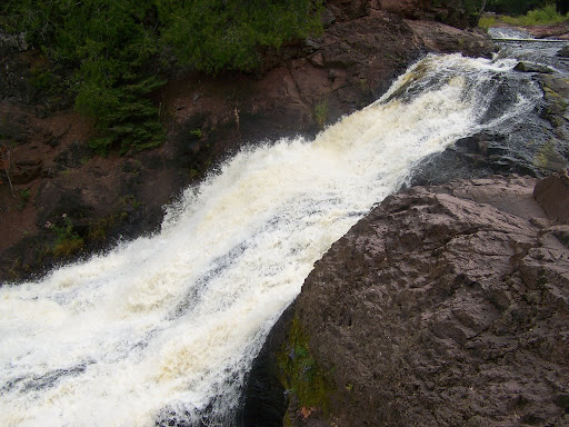
Saxon Falls is an intriguing waterfall. First, the waterfall is on the Michigan/Wisconsin border on the Montreal River. I viewed it from the Wisconsin side, but it may be easier to view it from Michigan. Second, I’m curious what the whole waterfall looks like. The bottom portion is hidden from view by trees. If it could be seen in it’s entirety, it would probably be surprising, since I’m guessing there’s an unseen 50+ foot drop.
The hike to the falls from the power dam is short, but does climb over some steep terrain. Be careful! There might be a way to view the whole falls, but I’m guessing that it would involve some steep cliffs and may even be illegal.
Directions:
- From US-2 in Wisconsin, turn north onto WI County Road B. Go for 2.5 miles.
- Continue straight on. Do not turn left onto County Road B. There is a sign indicating that you are heading toward Saxon Falls/Dam.
- Park in the parking lot near the power house.
- The trail will be to the right of the power house. Follow the unmarked but clearly trodden trail.
Accesibility: 7/10 (easy/moderate)
Height: 60′
Length of Hike: 0.7 miles round-trip
Where in the World is Saxon Falls?

Leave a comment