
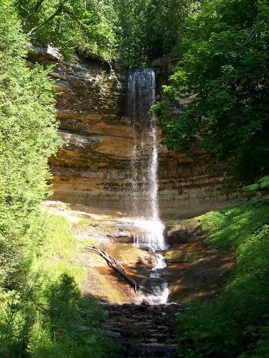
Munising Falls is one of the more popular waterfalls in the Pictured Rocks National Lakeshore partly because it is by far the easiest of the waterfalls to visit in the park. It’s essentially in the city limits of Munising (or at least very near), and the trail to the falls is very accessible, even if you have a handicap. Munising Falls is taller than it appears, but even in the spring, it doesn’t have a huge amount of water flowing over. It is still a year-round falls, though.
While you’re at Munising Falls, check out the sandstone. Many of the waterfalls in the area have carved through sandstone, as has much of the Pictured Rocks, and this is one of the best places to view it up close and personal. While you can see the falls from multiple different viewpoints, one of the viewpoints is accessible from a trail that heads up to a higher view of the falls. The sandstone comes in many different colors and is very interesting to touch. Look out for a lot of little “caverns” or holes formed in the side of the rock.
Directions:
- From Munising, head east on Alger County Road H-58.
- Turn left on Sand Point Road and follow the road to the signs indicating the parking area for Munising Falls.
*If you continue down Sand Point Road past Munising Falls, you can also visit a very nice, sandy beach and the Sand Point Marsh Trail, which is a beautiful trail with lots of wildflowers and wildlife.
Accessibility: 10/10 (easy)
Height: 50′
Length of Hike: 0.5 miles round-trip

Where in the World is Munising Falls?

Leave a comment