
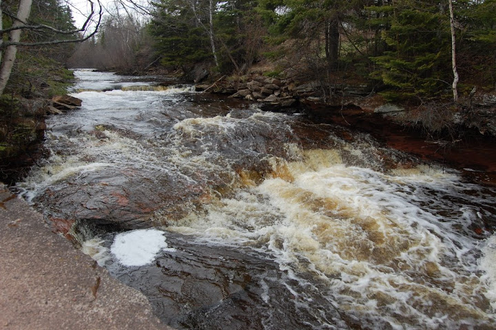
Tobacco Falls might not really even fall into the category of a waterfall. It might be more appropriate called a rapid. I visited Tobacco Falls in May. It is a rather easy to access, but also isolated. In May, after the snow had just recently melted, the water level on the Tobacco River was probably higher than it may be in July or August. I mention this because I have the feeling that in times of lower flow, Tobacco Falls may more closely resemble a waterfall. I could tell that there were some small drops that were flooded underneath the water, though I’m not sure if the water ever gets low enough to reveal those drops.
I wouldn’t recommend driving simply to see this waterfall, as it’s not that exciting. I would, however, recommend the drive that passes by the falls. The road that I took follows the Lake Superior shoreline for miles, and it is absolutely spectacular to be so close to the water and yet so isolated.
Directions:
- From Hancock, head east on M-26 for about 10.5 miles.
- Turn right on 9th Street and go for 0.1 miles.
- 9th Street turns into Bootjack Road and go for another 0.5 miles.
- Turn left on Traprock Valley Road Go for 1.4 miles.
- Turn right onto Gay Road. Head toward Gay. Gay Road changes names, often called Liminga Road or Lake Linden Road.
- Once you’ve reached Gay, which is extremely small, turn onto 2nd Street, which should turn into Lac La Belle Road.
- From here, you will be driving northeast. The falls are near the bridge that crosses the Tobacco River. There is a roadside park near there where you can park.
Accessibility: 10/10 (easy)
Height: 5′
Length of Hike: negligible
Where in the World is Tobacco Falls?

Leave a comment