
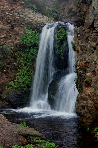
Just a few hundred feet above Alamere Falls are three other extremely beautiful drops as Alamere Creek travels toward the Pacific Ocean. While not as tall as the final drop, these two are just as photogenic and actually easier to view closeup, especially if you don’t want to make the tricky trek down to the shore.
Even reaching the upper falls is still a task. As you’re approaching the upper falls, you’ll be standing 30 or 40 feet above them at one point, and you’ll have to negotiate your way down the slippery but well worn paths leading to the upper falls. It’s not too bad, though it can seem daunting at first. You are likely to get dirty as you scramble down, and you will want to cover your camera well in order to avoid any damage. It was one of the muddiest treks I’ve ever taken.
Directions:
- Head toward Olema, California.
- In Olema, head south on CA-1 for about 9 miles toward Bolinas.
- In Bolinas, turn right onto Bolinas Road, which doesn’t have a sign. A GPS helped me find the road.
- In a very short distance, you’ll turn right onto Mesa Road.
- Head to the very end of Mesa Road and park in the parking area.
- You’ll start on the Palomarin Trailhead in the Point Reyes National Seashore.
- After a short distance, you’ll connect onto the Coast Trail for 3.5 miles or so.
- On your left, you’ll see a sign indicating a 0.4 mile hike to Alamere Falls. Take this trail, which is EXTREMELY narrow. Dress appropriately, as there are MANY trees and bushes that are there to attack you.
Accessibility: 3/10 (moderate/strenuous)
Height: 20′
Length of Hike: 8.8 miles round-trip

Where in the World is Upper Alamere Falls?

Leave a comment