
Quick Facts
Accessibility: 8/10 (easy/moderate)
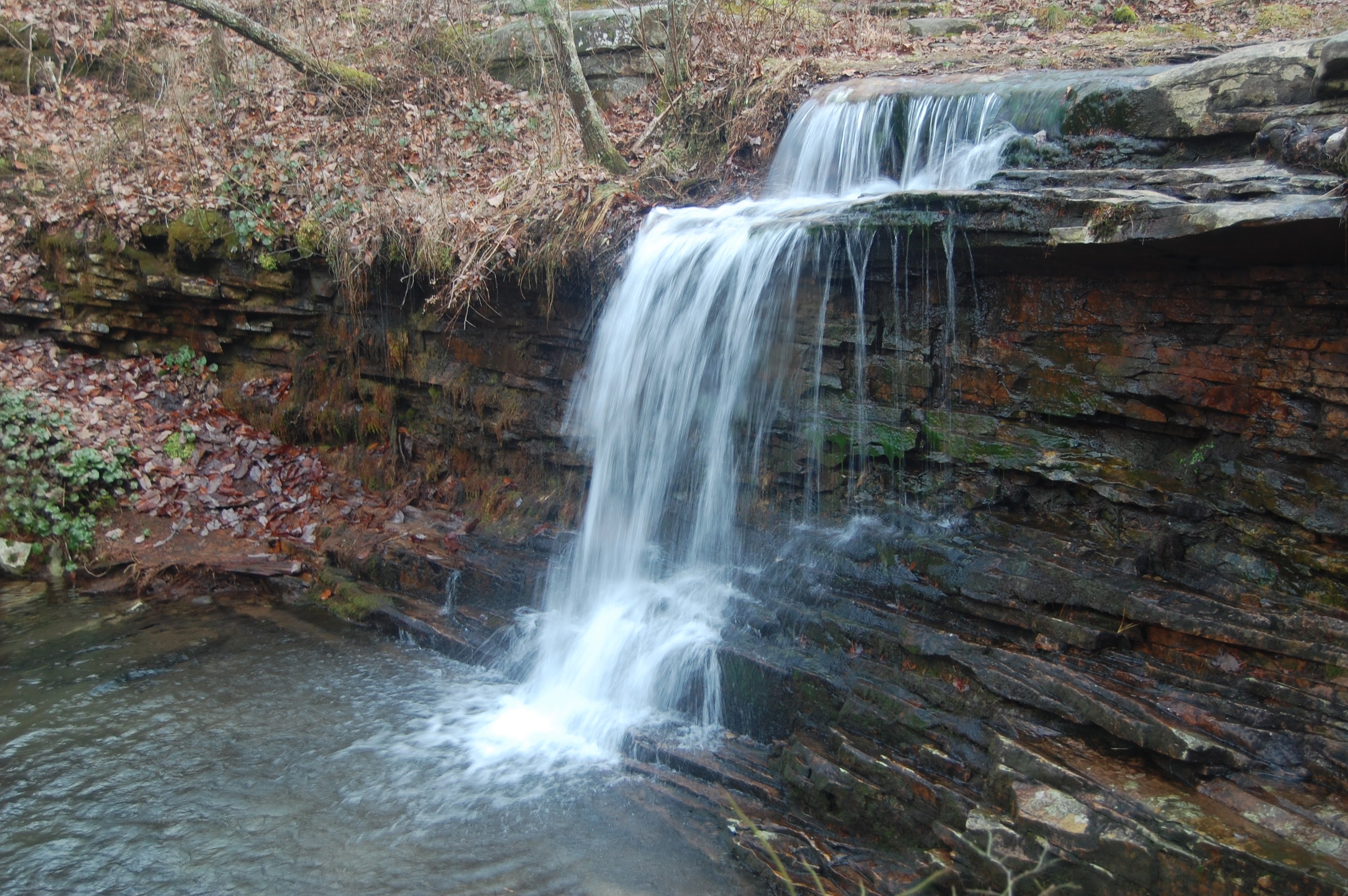
Height: 10′ / 3 m
Length of Hike: 2.5 miles / 4.0 km round-trip
The Record
Lost Falls isn’t truly “lost”. Obviously, somebody has found it. As you’re hiking to the falls, though, you may feel that you could get lost finding it. Not that the hike is all that difficult, but the trail meanders. You’ll walk through mini-cascades (you won’t get wet). You’ll pass by the sounds of flowing water that might make you THINK you’re near a waterfall, but you’re probably not…at least not a significant waterfall.
The trail leading to the falls is marked with red/orange markers. (You may also be able to find these falls on the blue trail.) This definitely does help, but you’ll need to pay attention. It’s so easy to get caught up in the beautiful forest around you, only to find out that you’re not where you thought you were. There were also several large trees blocking the trails in the winter months. The two falls along the trail, Laurel Falls and Lost Falls, are both marked with painted rocks…an interesting little touch. At least something is indicating you’re on the right path. I’ve been to some waterfalls where I’ve become far more lost.
Directions
- From I-59, head toward DeSoto State Park. There are multiple ways to get there, and the way I took did not pass through Fort Payne. Other directions go through Fort Payne.
- Follow the signs to DeSoto State Park. They’re clearly placed along major intersections.
- You’re heading toward DeKalb County Road 89. You’ll drive for a while on this road until you enter the state park.
- From the direction I entered, I saw the gift shop first. I kept heading down County Road 89, and if I had kept going, I would have gone to Fort Payne.
- Locate the parking area for the Azalea Cascades Boardwalk and park here.
- Head down the boardwalk past the Azalea Cascades.
- To your right, there should be a trail heading uphill that has red/orange diamonds posted on the trees. Follow this trail. (As mentioned, you may be able to follow the blue trail as well, and there is a Lost Falls Trail Head on the opposite side of this blue trail.)
- Pass the sign for the campground, continuing on the red/orange trail.
- After a ways (1/2 of a mile?), you’ll pass a rock on the ground painted with the name Laurel Falls. Keep going.
- After another 1/2 mile (?), you’ll end up at another rock for Lost Falls. Take that side-trail, which is rather short, down to the falls.

Leave a comment