
Quick Facts
Accessibility: 8/10 (easy/moderate)
Height: 8′ / 2 m
Length of Hike: 1 mile /1.6 km round-trip
The Record
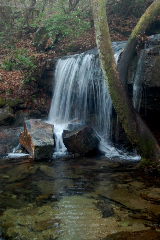
DeSoto State Park is most widely known for DeSoto Falls, which is an impressive waterfall in northeast Alabama. In a separate area of the park, there are several smaller waterfalls that are enjoyable. Laurel Falls is one of those waterfalls.
The hike to Laurel Falls is very peaceful. You first start down a boardwalk that leads to the Azalea Cascades. After passing the cascades, you begin your journey to Laurel Falls. It is not a difficult trail, but I do remember it being slightly confusing. Follow the red/orange diamonds to prevent yourself from getting lost. I also remember that in December, there were multiple large fallen trees blocking parts of the trail.
After about half a mile, you’ll come to a rock on the ground that is painted with the name Laurel Falls. Take the short trail to the falls, and you’ll be impressed. The falls along this creek are most likely dependent on recent rainfall. When I visited in December, the weather was amazingly comfortable, and the falls were flowing. I’m not sure that I would want to do this in the depths of summer, though the paths may be cleared of trees.
Directions
- From I-59, head toward DeSoto State Park. There are multiple ways to get there, and the way I took did not pass through Fort Payne. Other directions I’ve seen go through Fort Payne.
- Follow the signs to DeSoto State Park, as they’re pretty clearly placed along major intersections.
- You’re heading toward DeKalb County Road 89. You’ll drive for a while on this road until you enter the state park.
- From the direction I entered, I saw the gift shop first. I kept heading down County Road 89, and if I had kept going, I would have gone to Fort Payne.
- Locate the parking area for the Azalea Cascades Boardwalk and park here.
- Head down the boardwalk past the Azalea Cascades.
- To your right, there should be a trail heading uphill that has red/orange (blue trail may also get you there) diamonds posted on the trees. Follow this trail.
- Pass the sign for the campground, continuing on the red/orange trail.
- After a ways (1/2 of a mile?), you’ll pass a rock on the ground painted with the name Laurel Falls. Follow the short detour to the falls. If you keep hiking along this trail, you’ll also end up at Lost Falls.

Leave a comment