
Quick Facts
Accessibility: 10/10 (easy)
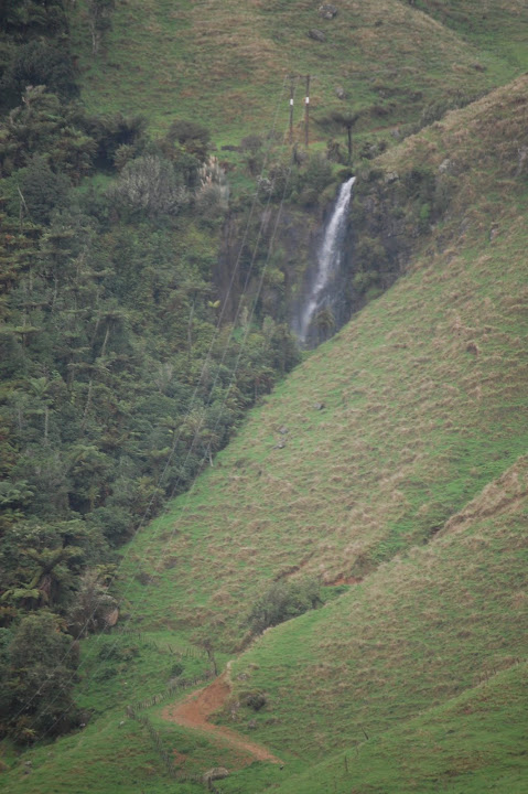
Height: 50′ / 15 m
Length of Hike: roadside
The Record
I’m not really sure how to describe this waterfall, considering I don’t really know its exact location. I was driving from Bridal Veil Falls (40 minutes from Hamilton) to Marokopa Falls. My GPS took me along some long stretches of unpaved road. I finally got onto some paved (sealed) road in farmland, and out of the corner of my eye, saw this small waterfall plunging to the left of me. I really couldn’t stop right there, so I turned around (which can be difficult on these winding roads). I zoomed in on the falls while stopped on the road for a few seconds. It’s not a very busy road, but if you can find another place to pull over for just a second, that might be the best option. That is, if you can “find” the falls?
Directions
Well…It’s on a paved road somewhere between Bridal Veil Falls and Marokopa Falls. Along the way, I believe I took Kawhia Rd. to Harbor Rd., then Te Wairere Road to get to Marokopa Falls. It might have been off one of those roads?
A random location update: In 2026, I attempted to use Google Gemini to determine the location of the falls based on recorded road “scans” (like Google’s Street View). It didn’t exactly pinpoint the location since this waterfall is rather isolated. So still an isolated waterfall…

Leave a comment