
Quick Facts
Accessibility: 3/10 (moderate/difficult…this hike requires some agility)
Height: 640′ / 198 m
Length of Hike: 3.1 miles / 5 km round-trip
The Record
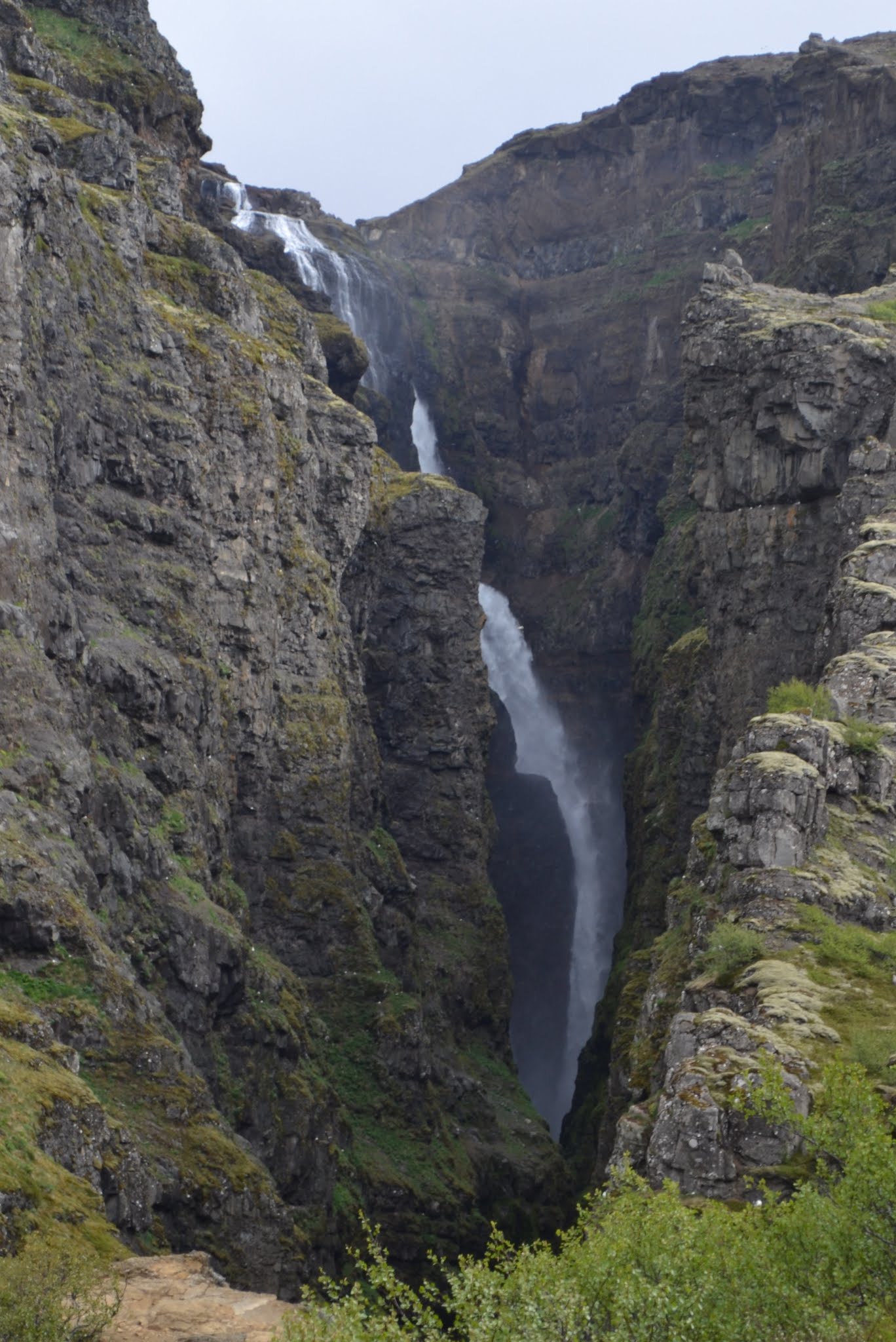
Standing at approximately 640 feet, Glymur is widely considered Iceland’s tallest and most impressive waterfall. To reach the trail, I suggest taking the scenic drive along Route 47 from Reykjavik (after exiting Iceland’s Ring Road). The route concludes with a mile-long, bumpy, unpaved road that is still manageable for 2-wheel drive vehicles. While previous guides described the trail as confusing, recent updates have added clear signage and yellow-painted trail markers, making the start of this peaceful trek much easier to navigate. (Those updates were made in 2012, so I’m assuming the signage is similar or improved.)
The hike itself offers a unique adventure, beginning with a descent through a small cave that leads toward the Botnsá river. To reach the falls, you must cross the river using a sturdy log and a metal guide wire for balance. While the crossing requires a bit of an “acrobat” mindset, it is far less daunting than it sounds and serves as a memorable gateway to the main ascent.
The final stretch is an upward climb along sometimes slippery slopes, though ropes and metal wires are available in steep sections for assistance. As you gain elevation, you will catch stunning glimpses of the massive falls, with the perspective shifting as you climb higher. While more daring paths exist for those comfortable with heights, the primary trail provides spectacular views of the “glimmering” falls without requiring extreme rock climbing.
Directions
- If you’re headed from Reykjavik, head north on the Ring Road (Route 1). Just before the Hvalfjörður tunnel, you’ll see a sign indicating Road 47. Take a right onto Road 47.
- Drive along Road 47 for a while. Along the road, you’ll pass another waterfall, Sjávarfoss.
- After driving about 34 km and crossing a paved bridge, you should almost immediately see a blue sign indicating the road to Glymur. Turn right.
- Drive for about 3 km to the end of the parking area. It can be a bumpy ride, so drive slowly.
- Start the hike to the trail. Follow the signs and the yellow rocks to guide you. If you pass through the cave and cross the river, you’ll know you’re headed in the right direction.

Leave a comment