
Quick Facts
Accessibility: 4/10 (moderate/strenuous)
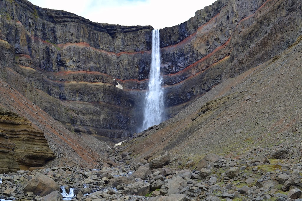
Height: 420′ / 128 m
Length of Hike: 3.1 miles / 5 km round-trip
The Record
Iceland has some pretty spectacular waterfalls, so it is difficult to choose one or two that really stand out as truly impressive. Hengifoss might just be at the top of the list. At just under 400′ or so, it’s a really impressive waterfall, and there are several other beautiful waterfalls downstream (including Litlanesfoss). It’s a truly spectacular view that has to be at the top of your list if you travel around Iceland.
I’ll have to be careful with my choice of words here. I guess the hike to the falls is simple. Once you start along the Hengifoss Track, there’s no real doubt about where to keep walking. The hike is not really easy, though. On the way to Hengifoss, you’re almost constantly hiking uphill, and at points you may be right near steep drop-offs. To get close to the main attraction, you will have to traverse a short but slippery slope that is very near the roaring river…and you’re just far enough above the river that it may cause some doubts. It’s definitely possible, though, and that’s coming from someone who is rather cautious in these situations. Heading back, you’ve got that same obstacle. After clearing that, it’s all downhill, and you’ll see numerous sheep along the way, too.
Once you reach the falls, though, you’ll be rewarded with the amazing Hengifoss! Its height is impressive. Even at a significant distance away, the falls stand out against the landscape. I spent a significant amount of time at the falls, though, taking photographs at every possible angle. The intense red layers sandwiched between the black basalt truly made for some cool shots. While there were some other hikers, Hengifoss was also just isolated enough that I was the only one near the falls, at least for a significant amount of time.
Note: If you wonder about clothing in Iceland, dress in layers. I visited in early June, and the weather was by no means terrible. As I was hiking up the hill toward the falls, though, the wind was intense and chilly. I was glad I had more than one layer on. Near the falls, the temperature actually begins to noticeably increase as you become sheltered by the cliffs around you.
Directions
- I started out at Egilsstaðir. Head south along Ring Road 1 for a few kilometers.
- Veer right onto Road 931, and drive for something like 17 km.
- At this point, I got slightly confused. You will reach a junction. Keep going on Road 931 across the bridge spanning the very wide river.
- A short distance after crossing the river, veer left onto Road 933. (It can be confusing, as Road 933 is also on the other side of the river, and they are connected, though it’s a rough, rough road.)
- Go just a kilometer or so to the parking area for Hengifoss. It’s pretty hard to miss, and it will be on your right.
- From the parking area, follow the Hengifoss Track.
Where in the World is Hengifoss?


Leave a comment