
This appears to be my first post about a waterfall in Matthiessen State Park in Illinois. This state park is nearby the more widely known Starved Rock State Park, which is known for its numerous canyons and seasonal waterfalls. Honestly, I had better luck with the waterfalls in Matthiessen State Park. Since both parks are within miles of each other, take the time to visit both.
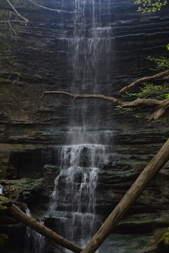
Lake Falls is the uppermost of the falls in the Dells region of the park. Though not seen in this picture, there is some man-made object above the falls. This has led to the suggestion that the falls might be a man-made product, though there is no indication of this (at least none that I can remember). The falls are directly under Lake Matthiessen. There is an oddly complex trail system around the Dells, so just try to explore a little bit. A map can be found online.
The falls aren’t extremely tall, somewhere in the 20-30′ range. In mid-April, there was some water flowing, which was more than could be said for some of the falls in the canyons at Starved Rock. As with most of the falls in the area, I’d expect the falls to disappear as the summer progresses.
Directions:
- Exit I-80 and head south along IL-178 toward North Utica (a small town).
- Keep heading south on IL-178 past the entrance to Starved Rock State Park. The entrance to Matthiessen State Park will be on your left (if you’re heading south).
- Head to the parking area, and then start hiking in the Dells Area. As mentioned above, the trail system is a little bit odd and complex, so just try and wander around. It’s pretty difficult to get completely lost.
Accessibility: 7/10 (easy/moderate)
Height: 25′
Length of Hike: 1.5 miles round-trip
Where in the World is Lake Falls?

Leave a comment