
Quick Facts
Accessibility: 10/10 (easy to view the base of the lower portion), 6/10 (moderate to go up a bit further)
Height: 100′ / 30 m
Length of Hike: 0.4 miles / 0.6 km round-trip
The Record
Trying to find a somewhat comprehensive list of waterfalls in Alaska is not an easy endeavor. The sheer size and remoteness of much of the state leads me to believe there are far more waterfalls than listed. I even remember watching one of the reality shows about mining gold in Alaska, and they had found a waterfall in some remote area. Alaska’s tourism website (found here) does a fairly good job of identifying 20 or so waterfalls, but it is incomplete.
Exhibit A: Pioneer Falls. I was staying at cottages near Palmer and Wasilla, looking at Google Maps to see if anything was interesting to do in the area. And as I scanned the page, by pure chance (or what seemed like it), I noticed a marker for “Pioneer Falls Trailhead”. I hadn’t seen this waterfall in my research and decided to search a little more. It seemed like Pioneer Falls existed, and after discovering it was on a paved road, I decided to check it out.
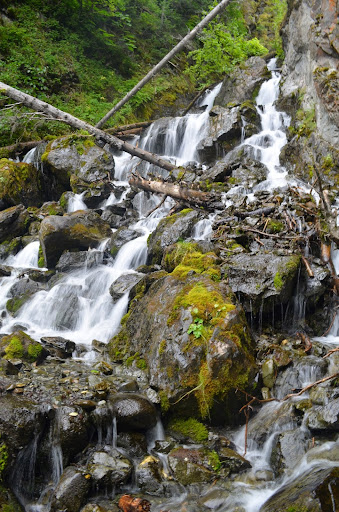
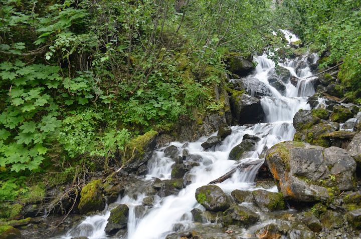
Pioneer Falls is surprisingly easy to get to, and it’s a very short hike to view the falls up close. One reason Pioneer Falls might not be widely visited: it’s a difficult waterfall to view in its entirety. I’ve said before, I’m a terrible judge of heights, but I’d guess the total drop is greater than 100′. From any portion along the trail, though, you’ll see a small piece of the complete falls. From the gravel parking area, you’ll have a pretty good view of the uppermost drop. As you start hiking toward the falls, you’ll get a better view of the lower and middle portions, but even those are almost impossible to view together. So it’s rather hard to gain a full appreciation for the waterfall. I don’t know if I would seek out just Pioneer Falls on its own, but if you’re headed from Anchorage to Palmer, you can see Pioneer Falls while also stopping at Thunderbird Falls and South Fork Eagle River Falls.
Directions
- From AK-1 (Glenn Highway), take the exit onto Old Glenn Highway (just before you cross over the Knik River).
- Head east along Old Glenn Highway until you get to E. Knik River Road. (Old Glenn Highway veers to the north and crosses over the Knik River), while E. Knik River Road continues east.
- Continue along E. Knik River Road for 1.2 miles. On your right, you should see a sign for Pioneer Falls.
- Continue for about 50 more feet to a gravel road on your right. There’s a mailbox there on the right, and when you turn onto this gravel road, it goes for a short distance to an oval parking area.
- Park in this gravel lot, and you will be able to see the falls from here. It’s maybe a 0.2 mile hike to the falls, if that much.
Be careful. If you decide to hike further up, realize that the trail can be slippery in places. Exercise caution!

Leave a comment