
I like to head out to California for short trips, and San Francisco is one of the best places to start a journey. There are so many different things to be viewed in the area. There are a number of waterfalls in the area, but they’re spread out in all different directions. Check out Mountain View Falls, Alamere Falls, and McWay Falls as examples. In Big Basin Redwood State Park south of San Francisco, there are a few waterfalls that require significant hikes to arrive at (Berry Creek Falls and Silver Falls). I didn’t hike to those falls since I had no wish to go that far. So instead, I hiked to Sempervirens Falls.
I tend to get a late start (not a morning person), so when I arrived at Big Basin SP, parking was at a minimum for a beautiful Saturday in April. Parking is found along Escape Road, and I kept driving. The cars were parked alongside, so I just kept going. I found ample parking at the end of Escape Road and realized that it would be easier to take a completely different path than I had originally planned.
At the end of Escape Road, I headed north past the fence where Escape Road officially “ends”, though it continues as a walking path. After a few hundred feet, I took a sharp right onto the Sequoia Trail. I continued along this path, crossing CA-236. The Sequoia Trail continues downhill to the falls (which are to your right as you reach Sky Meadow Road. The most difficult portion of the hike is the uphill climb on the return.
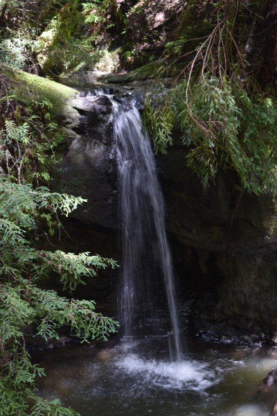
I’m not sure I’d go out of my way to see Sempervirens Falls, though the surrounding redwoods make up for the smaller-than-expected waterfall. It’s at most 20′ tall and is rather narrow. Still, enjoy the scenery!
Directions:
- Before heading to Big Basin Redwood SP, check their website to see if it’s open. Wildfires may impact the park’s accessibility.
- From CA-9, head in the general direction of CA-236. (CA-236 forms a loop so that you can connect from the north or south along CA-9.)
- CA-236 loops through Big Basin Redwood State Park. It’s a rather narrow road.
- Pay the entrance fee, and then find parking. If you find parking close to the entrance, you can follow the Sequoia Trail to the falls by heading north. Since I found parking as described above, I found the Sequoia Trail in the opposite direction.
Accessibility: 6/10 (steep uphill climb on the way back)
Height: ~20′ / 6 m
Hike: ~2 miles / 3.2 km round trip
Where in the World is Sempervirens Falls?

Leave a comment