
Quick Facts
Accessibility: 8/10 (easy/moderate)
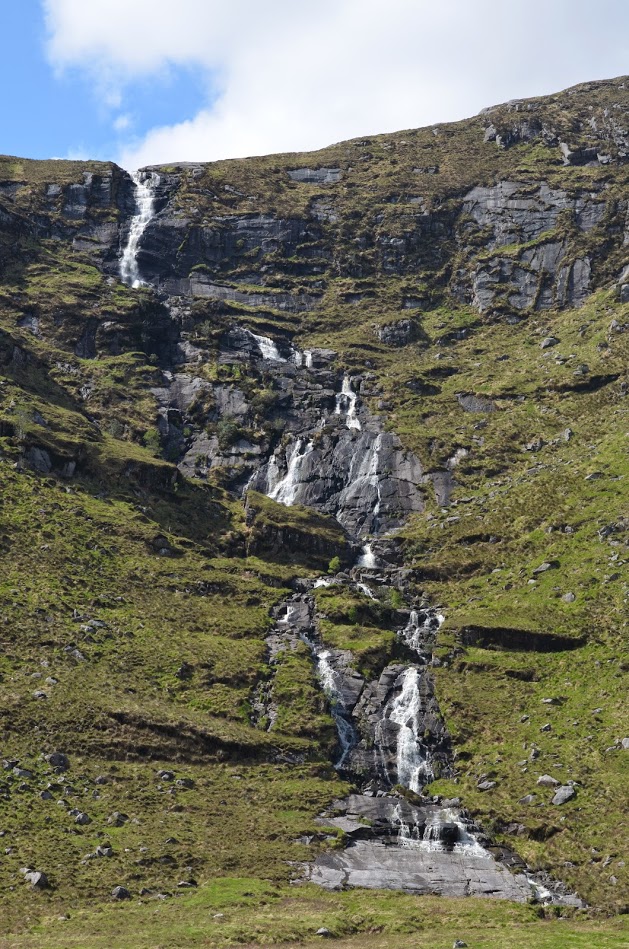
Height: 590′ / 180 m
Length of Hike: 4.5 miles / 7.2 km round-trip
The Record
When I visited Astellen Falls in 2014, there wasn’t much information about this waterfall and others online. Now there are more sources of information to determine the heights of waterfalls. Powerscourt Falls outside of Dublin has been advertised as the tallest waterfall in Ireland at 397 feet (121 meters) tall. Astellen Falls is taller than Powerscourt Falls at 590 feet (180 meters). Some estimates put that closer to 700 feet tall…in either situation, it’s a tall waterfall.
A few reasons why this waterfall is not more advertised: First, Astellen Falls is not as easy to get to from a trip perspective. It’s about a 3-hour drive from Dublin to Glenveagh National Park. That also means it’s a relatively isolated, quiet, and yet stunningly beautiful national park. Second, it’s a 4.5-mile round-trip hike to see the falls (which again is absolutely worth it for the scenery), and once you reach your destination, you’re not particularly close to the falls. If you’re into photography, I suggest you bring a lens that can zoom in well. A cell phone camera is not going to capture much here.
The waterfall is beautiful, the park is beautiful, and there’s so much else to see in Glenveagh National Park. There is a castle (which I don’t think I viewed, as I don’t have any pictures), and there’s also a castle garden (which I did walk through). If you get the chance to explore the northern portion of Ireland, it’s definitely worth it!
Directions
- There are several ways to arrive at Glenveagh National Park, but the most sensible one would be to take the N56 (near Letterkenny) northwest toward the park.
- After some distance, turn left onto R255.
- After a short distance, turn left onto R251. (I believe there was pretty clear signage along the way).
- To get into the park, you park at a designated area and take a bus to the castle/gardens.
- From the castle/gardens, start your hike south along Lough Beagh. After about 2.2 miles of hiking, you’ll see the falls across Lough Beach to your right.

Leave a comment