
Quick Facts
Accessibility: 10/10 (easy)
Height: 107′ / 33 m
Length of Hike: 0.1 miles / 0.15 km round-trip
The Record
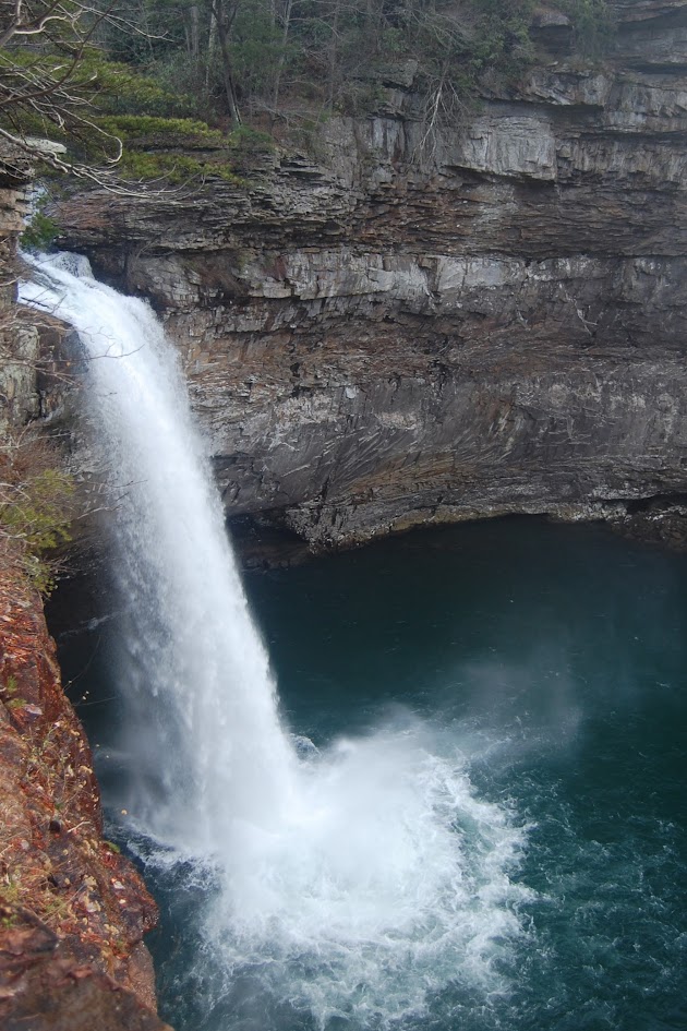
I don’t always take a logical or obvious path…DeSoto Falls is the main waterfall in DeSoto State Park, and yet I wrote about four other waterfalls before arriving at the main attraction. Some randomness has led to writing about this 10 years after the initial visit. While I’ve spent time highlighting the park’s smaller cascades, this is one of those falls that is hard to forget! At 107 feet, it is one of the most visited waterfalls in Alabama. The intense plunge has geologically carved a horseshoe-shaped canyon, and I couldn’t help but try to capture the canyon with the falls. The falls wouldn’t be so stunning without the stunning canyon walls.
DeSoto Falls’ accessibility is its greatest strength. While I enjoy a good hike to find a waterfall, I will always appreciate those that are easy to visit. It’s a short walk from the trailhead, leading you directly to the roar of the water. This waterfall is difficult to forget. If you find yourself in northeastern Alabama, this is almost a required stop. And there are so many other waterfalls in the area!
Directions
- From I-59, take exit 231.
- Head southeast on AL-40 toward Hammondville/Valley Head.
- Turn right onto US-11 for a short while.
- Turn left onto AL-117 south and drive for 3 miles through Valley Head. You will turn sharply right onto an apparently unnamed road. If you end up in Mentone, you’ve gone too far.
- Turn left toward County Road 613 and then continue on that road. You should end up at the DeSoto Falls Picnic Area.

Leave a comment