
In June, I went on a road trip (social distancing style) from Las Vegas to Michigan. The first waterfall stop on the trip was Lower Calf Creek Falls. The next stop was in Colorado. The waterfalls we visited had to be easy to get to from the main freeways and also had to be shorter hikes. Rifle Falls fits into both of those categories.
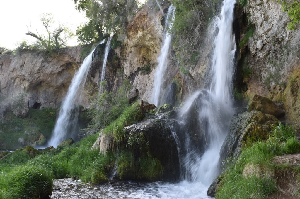
From the parking area, it was an easy hike to Rifle Falls, a fascinating waterfall. A sign near the falls says the waterfall likely formed when minerals built up around a beaver dam (or something of that sort). I don’t know if I’ve stopped at any other falls that may have been formed that way. At the falls, there are multiple different viewpoints. It is one of those that definitely changes as you’re looking at it from the sides versus head-on, and that makes it fun to photograph. It’s definitely a waterfall that’s worth a stop if you’re along I-70 in Colorado.
Directions:
- We were headed east through Colorado along I-70 and took exit 87 before Rifle.
- We then turned left onto US-6, which follows I-70 into Rifle. Before entering Rifle, we turned left onto CO-13.
- CO-13 skirts Rifle and then just north of Rifle, we turned right onto CO-325 heading north.
- Rifle Falls State Park is on CO-325, but you veer right and then left before arriving. When you reach the Rifle Gap Reservoir, you veer right, and then when CO-325 splits with Road 226, you veer left again. It’s pretty hard to miss Rifle Falls State Park if you stay on CO-325.
- From the parking area, you head north to see Rifle Falls.
Accessibility: 10/10 (Easy)
Height: 70′
Length of Hike: 0.2 miles round-trip

Leave a comment