
Looking at the map just now, I didn’t realize (or maybe remember?) that Spoonauger Falls was so close to the South Carolina/Georgia border. Georgia’s just a stone’s throw from the Spoonauger Falls and it’s partner, Kings Creek Falls. I don’t remember going as far as Burrells Ford, but the road to the falls crosses over into Georgia.
I didn’t go as far as Burrells Ford because the parking area that leads to both falls is right before you would need to cross the Chattooga River. If you head right/north from the parking area, you’ll find Spoonauger Falls. If you head left/south, you’ll find Kings Creek Falls.
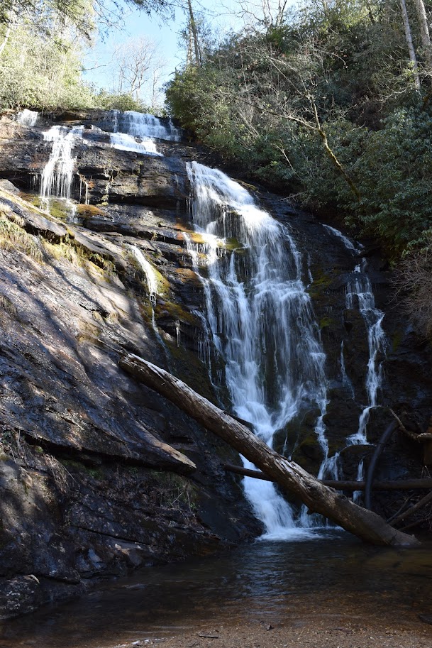
Spoonauger Falls is the shorter of the hikes, and is an easier, straight shoot to the falls. It must have been some uphill and downhill hiking since I rated it as a moderate hike. It’s a really beautiful waterfall, and the fact that it wasn’t too difficult to arrive at the falls and then hike to this and another waterfall makes it a worthwhile set of waterfalls to visit!
Directions:
- Drive along SC-107 (in between the North Carolina border and Oconee State Park).
- Find Burrells Ford Road. If heading south along SC-107, it will be on your right. Turn onto Burrells Ford Road.
- Drive for about 2.5 miles along the road to a parking area on your left. It’s mostly gravel, but it’s well kept.
- Park and look for the kiosk near the front of the parking area. The trail to the falls starts right after the kiosk.
Accessibility: 6/10 (moderate)
Height: 50′
Length of Hike: 0.6 miles round-trip
Where in the World is Spoonauger Falls?

Leave a comment