
We recently took a trip through Minnesota, Wisconsin, and Michigan’s Upper Peninsula. Along the way, we stopped at a few different waterfalls. I’ve visited a number of waterfalls in Wisconsin, and they’re mostly in the northern portion of the state. Near Duluth, there are Big Manitou Falls, Little Manitou Falls, and the falls in Amnicon Falls State Park. To the east, there are Copper Falls, Potato River Falls, and many falls along the Michigan/Wisconsin border, a favorite being Superior Falls. There are definitely enough falls in the north of Wisconsin to spend at least a few days there exploring.
Oddly enough, one waterfall I hadn’t visited until recently was Morgan Falls. Some waterfall enthusiasts list it as their favorite waterfall in Wisconsin. It’s also very close to the other falls I’ve listed above. I’m not sure why I didn’t stop when I was in the area during previous visits. I made sure that it was the top visit on this trip.
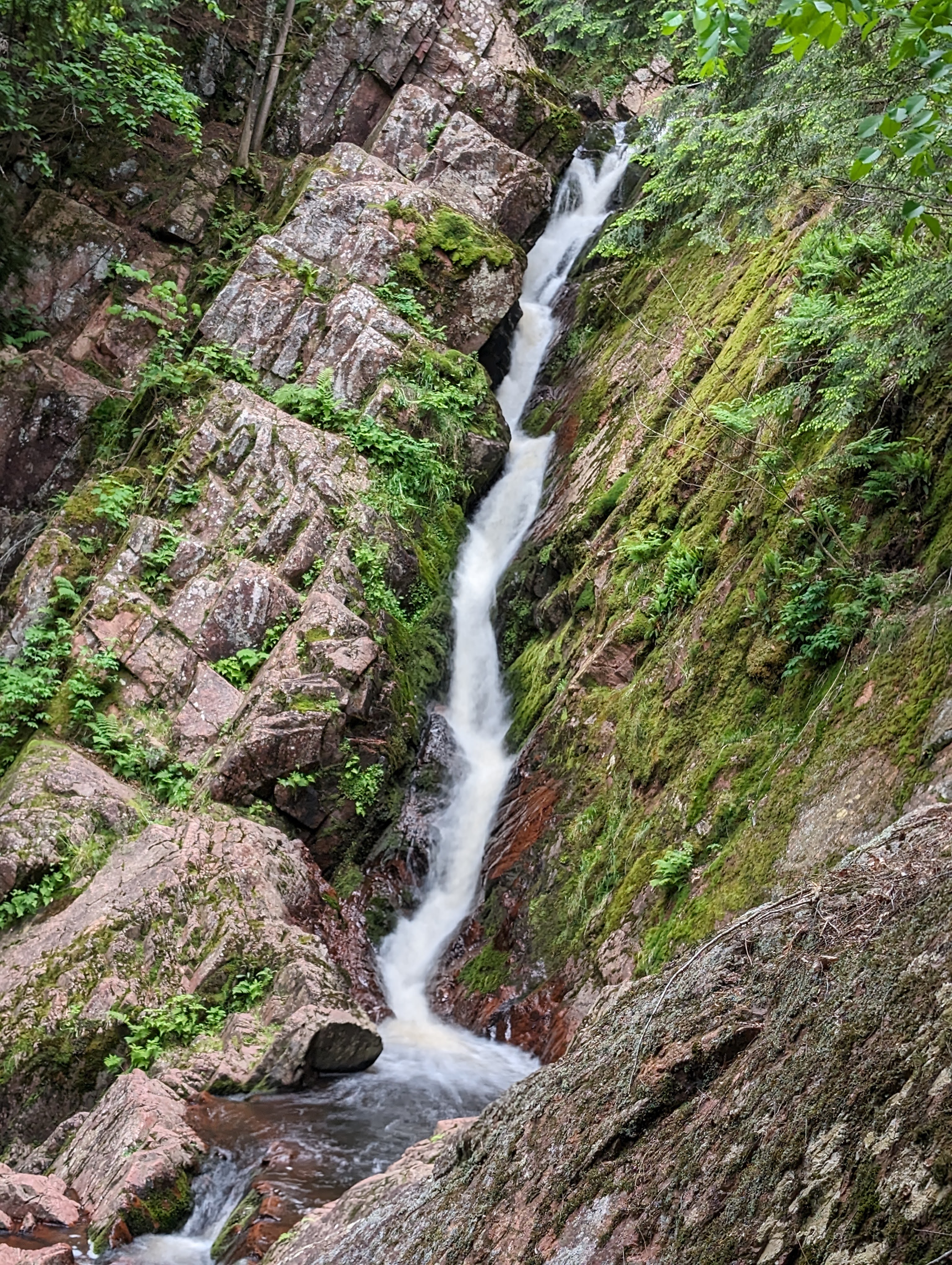
And I would say Morgan Falls doesn’t disappoint. I’m not sure I would rate it as my favorite waterfall in Wisconsin. Big Manitou Falls or Potato River Falls might be my two favorites. But Morgan Falls is definitely a unique waterfall, so I can understand why it would be a main attraction. We were the only ones at the trailhead, though! We had the place to ourselves. One great thing about this hike: While it is 1.6 miles round-trip, it is one of the more accessible hikes I’ve been on in a long time. I think with some minor help, someone in a wheelchair could go the whole distance. It seems like that was a focus of those who set up the trail. The trail to the falls is rather flat, which is what made me wonder about the falls. The rockface just kind of appears and there’s this waterfall seemingly out in a rather level marsh area. And at 70′ tall, it’s not just a tiny waterfall that appears! The waterfall is geologically very interesting because of the way it seems to just pop up and follow the slanted rocks.
Directions:
- As with some of the other waterfalls in northern Wisconsin, Morgan Falls is somewhat isolated. The falls are found on County Road (?) 199, also known as Ashland Bayfield Road.
- Ashland Bayfield Road is a dirt road and there are many other dirt roads that could lead you there. We were heading toward Ashland on US-63, and turned right onto County Road E. County Road E is the main paved road that leads to Ashland Bayfield Rd.
- If you’re headed east on County Road E, you’ll turn right onto Ashland Bayfield Road and head south for a few miles.
- One quirky thing: Google Maps shows the parking area on the south side of Morgan Creek, but it appears a new parking area is on the north side of Morgan Creek. The new parking area is not far from the old one, but we didn’t follow Google perfectly.
- There is a day fee to visit the falls since it is part of the US Forest Service. I was impressed there was a kiosk that accepted credit cards. We have a National Park pass, so we placed that on the dash of the car, as that is also an acceptable way to enter.
- It’s definitely worth the $5 day fee to then hike to the falls. The hike is pretty darn flat, though there are a few wood bridges over some marshland and creeks. The bridges are not steep, but almost as flat as the surrounding land. For a 1.6 mile round-trip hike, I rated this as a 10/10 for accessibility, which is rare for a hike of that length.
Accessibility: 10/10 (easy)
Height: 70′
Length of Hike: 1.6 miles round-trip
Where in the World is Morgan Falls?

Leave a comment