
Quick Facts
Accessibility: 10/10 (easy)
Height: 92′ / 28 m
Length of Hike: 0.1 miles / 0.15 km round-trip
The Record
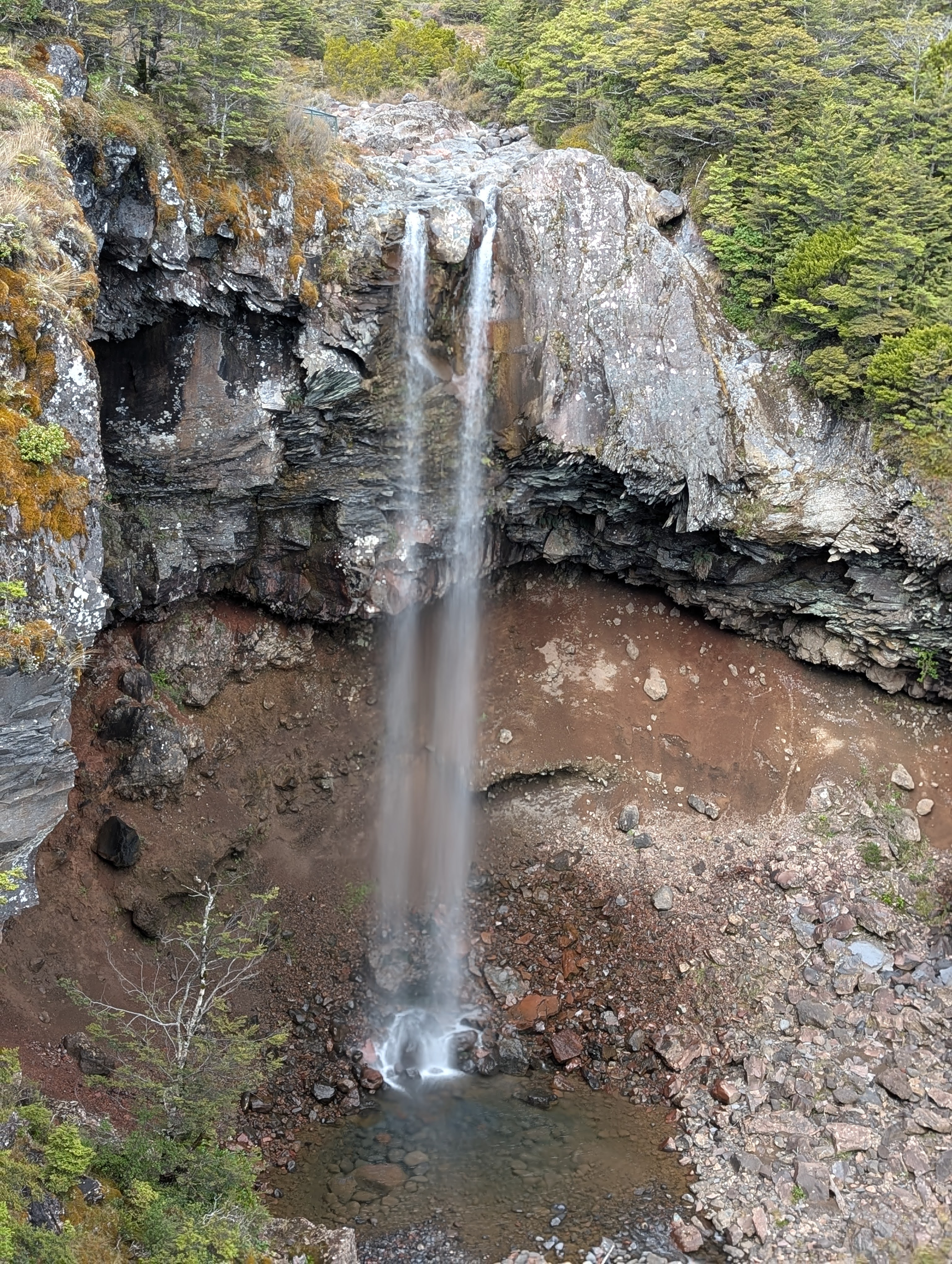
Mangawhero Falls is just one stop along an almost surreal experience, at least to me. Tongariro National Park in New Zealand contains three active volcanoes. A set of roads form a ring road around the park. On the south side of the park, Taranaki Falls and Tawhai Falls are on relatively flatter ground. And before I go any further, I should mention this drive is very seasonal. Your experience will be completely different in summer versus winter. Please take that into account when planning!
To get to Mangawhero Falls, you’ll start in Ohakune (elevation 582 meters/1909 feet). You can AND should drive up to the Tūroa Ski Area, about 17-18 kilometers up. The elevation at the ski area is 1600 meters/5,249 feet, so you’ll traverse some awesome terrain over that distance. Keep in mind, this is an active volcano, Mount Ruapehu…It last erupted in 2007, for 7 minutes…not a long time, but still non-zero! The landscape in this area is changing at a rapid pace, geologically. Also noticeable was the temperature change as we climbed. It was southern/austral summer (December), but the temperatures were rather chilly at the ski area, and Mount Ruapehu climbs a further 1197 meters/3,927 feet! (Total height to Tahurangi, the highest peak on Ruapehu: 2797 meters/9177 feet)
Out of the three volcanoes in the park, Mount Ruapehu has the only glacier system, though the glacier has been receding due to climate change/volcanic activity. The result of the glacier system, though, is a consistent source of water for flowing water! Mangawhero Falls is at an elevation of 1515 meters/4970 feet, and is an eerily beautiful waterfall. You can see much of the earth’s recent history here. It doesn’t take a long hike to get there. It’s a short distance from a parking area. And you’ll also get to say you’ve been to Gollum’s Pool. (LOTR geeks will know.)
If you continue up to the ski area, you’ll notice the trees disappear suddenly, right around the time you leave the parking area. You’ll be driving up the “side” of an active volcano. They’ve found the safest path possible to the ski area. From the ski area, you could decide to hike further. I’m just not knowledgeable enough to comment about that part. I was content stopping at the ski area before heading down, an equally amazing experience that provides different views of the mountain volcano.
Directions
- Ohakune is a small city at the edge of Tongariro National Park. You’ll want to find your way here, and it’s simple…the only major road that leads here is State Highway 49, with one or two other less-utilized options.
- Set your GPS to Mangawhero Falls, and it will lead you northeast along Ohakune Mountain Road. You’ll reach the parking area for Mangawhero Falls 13 kilometers or so. I remember the parking area being pretty obvious from the road. Just a bit south (downhill), there is a trailhead for Waitonga Falls. We didn’t visit Waitonga on this journey.


Leave a comment