Daisy Low Falls, Indiana

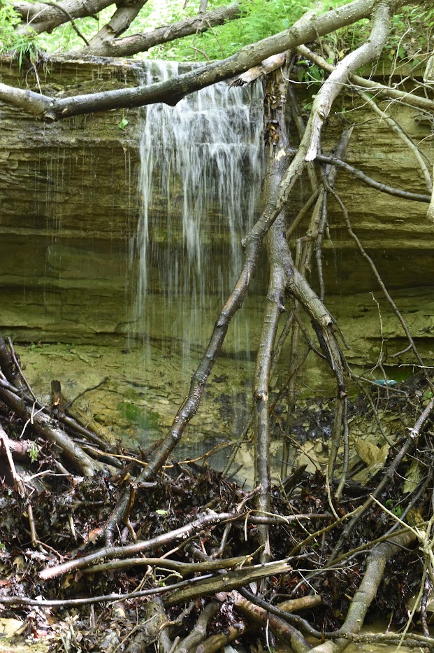
Daisy Low Falls in May 2017

There are waterfalls in Indiana, and while smaller, some of them can be very fun to visit. In the Kokiwanee Nature Preserve, there are three falls. Check out Kissing Falls for more info about where I parked and started along the trail.

Daisy Low Falls is the second waterfall I encountered, and I was able to capture some good pictures of this waterfall. Frog Falls was the most difficult to capture. I somehow knew to look for Daisy Low Falls, even though it doesn’t show up on the current Kokiwanee ACRES Land Trust map. ACRES takes care of the lands here. Their map shows Frog Falls, and I know that Daisy Low Falls was in between Kissing and Frog Falls, Kissing being the first waterfall I found along the trail.

There’s a trail that follows the Salamonie River, and that’s the one that I took to find Daisy Low Falls. ACRES land trust still rates this as a more difficult hike, though I believe they’re referring to the a much larger loop you can take. I did not find it to be a difficult hike or trail to the falls, though I remember doing some uphill hiking on one of the trails to find Frog Falls. The one thing I would caution: It was very muddy on the day I arrived at the preserve. It had rained the day before, so I had to be careful not to slip, but that was the main issue. I don’t remember climbing much uphill.

Directions:

  1. This is an instance where there’s not an obvious starting point. You can approach from multiple directions. It’s in between Wabash and Huntington south of US-24.
  2. The official entrance to the park is off of E 50 S (GPS at 5825 E 50 S, Lagro, IN 46941). I instead went to the intersection of E 50 S and Stone Road, and went south on Stone Road, turned right onto the road that led to the Salamonie River Boat Launch (can’t remember if there was a more specific name).
  3. At the end of this road, there’s a parking area. The trail to the falls starts at the end of the parking area (read above).

Accessibility: 9/10 (easy)
Height: 10′
Length of Hike: 0.3 miles round-trip

Where in the World is Daisy Low Falls?
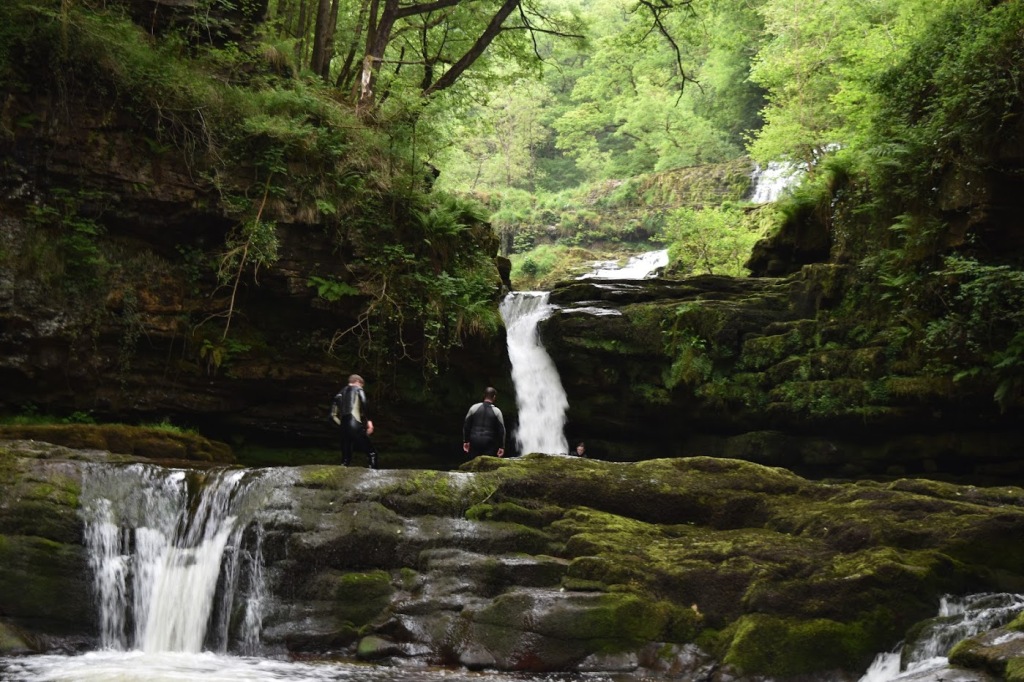
Sgwd Isaf Clun-Gwyn (Lower Fall of the White Meadow), Wales

The Four Falls Trail in Brecon Beacons National Park is a really beautiful hike to see…four waterfalls! The first waterfall you see is Sgwd Clun Gwyn (Fall of the White Meadow). It’s the easiest of the four falls to visit. After Sgwd Clun Gwyn, it becomes far more strenuous to see the other three falls.

Sgwd Isaf Clun-Gwyn is along the same river, hence the “Lower” Fall of the White Meadow in English. And to get to the lower falls, you’ve got to head downhill. And that’s uphill and downhill for the other two falls also. While a hike to two falls might be moderate, when you add two other falls on top of these two, it becomes a rather strenuous hike, in my opinion.

The falls are very beautiful, to say the least. Sgwd Isaf Clun-Gwyn might be the most complicated of the falls. Depending on the source, the falls are listed at 20-30 meters (~60-90 feet). At the “viewpoint” for this falls, the viewpoint being in the middle of the river, you can’t see all of the drops. You can see some smaller drops very clearly and can also get a glimpse of some of the larger drops. But I couldn’t get a glimpse of the whole shebang. There are four or five drops that compose Sgwd Isaf Clun-Gwyn, so some people might classify this as four or five separate waterfalls.

Directions:

  1. Main route A465 will likely be your starting point. Take the exit to Glynneath, which will put you on A4109.
  2. From A4109, you’ll very quickly after turn right onto B4242, and then left onto Pontneathvaughan Road. You’ll continue on this road for about 5 miles.
  3. Google Maps tried to direct us down a very narrow country road (which didn’t have any signage for the falls). I continued until I saw the actual sign for the waterfalls trail, and turned right. It was still a very narrow road but it led us directly to the Cwm Porth Car Park. (You can also start at the Gwaun Hepste Car Park, though it does lead you down some different trails.)
  4. There is a £4 fee to park, and then you can start the hike to the falls.

Accessibility: 3/10 (moderate/strenuous for whole set)
Height: 40′
Length of Hike: 5.5 miles for the whole set

Sgwd Isaf Clun-Gwyn in June 2018 with some people in wet suits (not sure what exactly they were doing) for reference

Where in the World is Sgwd Isaf Clun-Gwyn?

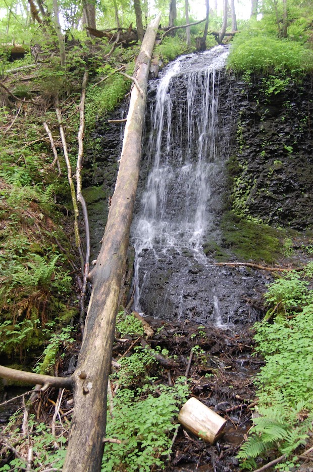
Unnamed Falls #1, Raymondskill Area, Pennsylvania

A waterfall near Raymondskill Falls in May 2019

In certain places, there can be a number of different waterfalls…so many so that people don’t know what to do with them all. They may not put them on a map or name them. Raymondskill Creek is one of those areas. I’ve got six waterfalls on the map, though the main focus is impressive falls Raymondskill Falls. I’ve posted about the other five waterfalls, so I’m now at the sixth.

Of course, I visited the falls in 2019, so it’s possible that the paths have changed in the 14 years since I’ve visited. Maybe names have been attached to some of the falls. This and the Unnamed Falls #2 may be ephemeral (seasonal) waterfalls, so it’s possible they may not be as interesting in the depths of the summer. It was warm when I visited in May of that year and there were some intense storms producing some rainfall while I was visiting the area, so it made for some great waterfall viewing.

Directions:

  1. From I-84, take exit 46 to Milford.
  2. Go east on US-6 for a little more than 2 miles.
  3. Go south onto US-209 for 2.5 miles.
  4. Turn right onto Raymondskill Road. Go 0.3 miles to the parking lots. There are two different parking areas, one with a visitor’s center. Park at the first one that you encounter.
  5. From there, the trail will split. Take the trail that heads to the left. It might split again (I can’t remember.). If so, take that left also, and you’ll head downhill on a moderately steep slope. From here you’ll see the falls.

Accessibility: 7/10 (easy/moderate)
Height: ~20′
Length of Hike: 0.4 miles round-trip

Where in the World is Unnamed Falls #1?

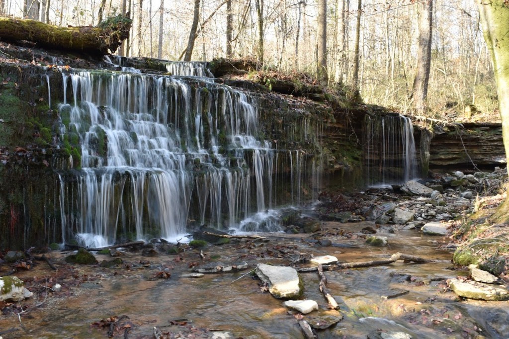
City Lake Falls, Tennessee

Cookeville, Tennessee could be considered a hub for some impressive waterfalls. Burgess Falls, Cummins Falls, and Waterloo Falls are not far outside the city, and there are a number of other falls are close by. Inside the city (or very close to the city) is a smaller but beautiful waterfall.

City Lake Falls is about 6′ tall, so it doesn’t register compared to some of those listed above. The park, or at least the area around the falls, wasn’t wildly busy, so it was very peaceful at the falls. And while there wasn’t a significant amount of water flowing, the water that was falling allowed for some beautiful pictures. I was impressed at the calmness near the city.

The walk/hike to the falls is not difficult, and so this is one that would be appropriate for children. It would be a nice stop if you’re in the area and need a break from driving or to burn a bit of energy and get out in nature. And as mentioned, you’re not far from some other very impressive falls. Cummins Fall is a single waterfall, but Burgess Falls is really a collection of many pretty impressive drops.

Directions:

  1. If you’re driving along I-40 in Tennessee, take exit 290.
  2. Head south on US-70N (aka E Spring Street) for 0.3-0.5 miles, depending on whether you were heading east or west on I-40.
  3. Turn left onto Poplar Grove Road. Poplar Grove Rd will veer left, but instead continue forward on Bridgeway Drive.
  4. City Lake Natural Area will be on the left a short way along Bridgeway Drive.

Accessibility: 10/10 (easy)
Length of Hike: 0.3 miles round-trip
Height: 6′

City Lake Falls in November 2017

Where in the World is City Lake Falls?

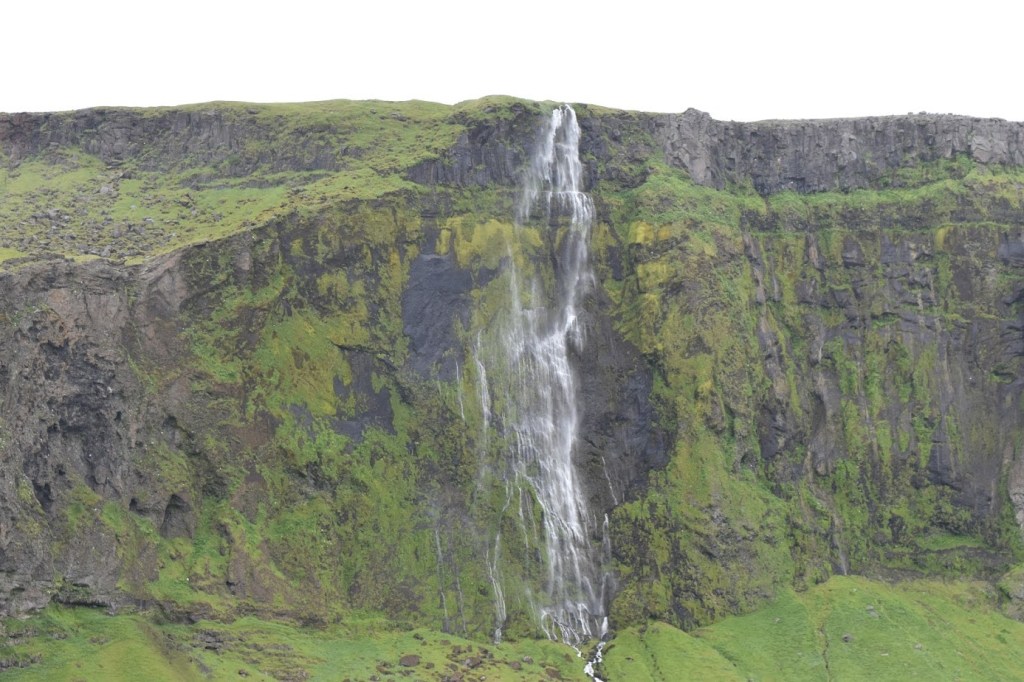
Paradísarfoss, Iceland

In Iceland, there are so many roadside waterfalls that it can be hard to keep track of them. Many of them have no official name written next to them. They might be ephemeral, and they may not stand out from the many other waterfalls you can view as you’re driving around Iceland.

In June 2012, I first visited Iceland, and I have pictures of Paradísarfoss. It’s not far from Seljalandsfoss, one of the most popular waterfalls in Iceland. It’s also viewed from the Ring Road, the main road that goes around the island. I didn’t have a name for it, though. When I came back to visit in July 2017, I saw the falls again as I took my family to many of the same sights as before. In 2017, I had a book of Iceland waterfalls and the name may have been listed there. The other possibility is that the falls now showed up on Google Maps, which had improved since 2012.

Whatever may have been the case, I was able to update the name. Another name seems to be Drífandi. Which I guess is significant, because I thought the waterfall was impressive, though maybe not as big or intense as some of the other falls in the area. It’s about 200′ fall tall. When the wind is blowing, which can be often in Iceland, the wind pushes the water so that it doesn’t fall in a vertical cascade, but more of a bent cascade. There’s a few other falls I’ve seen that noticeably do this.

Directions:

  1. Paradísarfoss/Drífandi is found on the southern portion Ring Road. It is found east of Arborg.
  2. If you are heading east, you will pass Road 249 (Þórsmerkurvegur) which leads to Seljalandsfoss. Shortly after that, in about 1 mile, you’ll see the falls on the left.
  3. I believe there’s somewhere to pull off and view the falls, though the road is never wildly busy.

Accessibility: 10/10 (easy)
Length of Hike: roadside
Height: 200′

Paradísarfoss in July 2017

Where in the World is Paradísarfoss/Drífandi?

‘Ōpaeka’a Falls, Hawaii

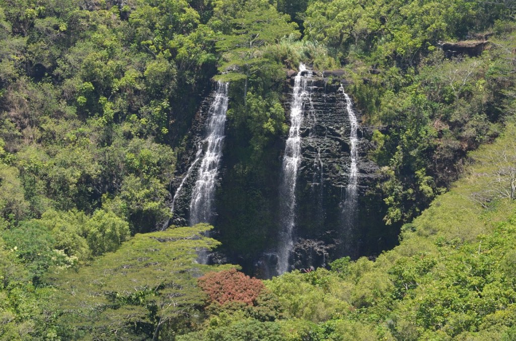
On Hawaii’s main tourism website, it says that ‘Opaeka’a Falls is one of Hawaii’s most accessible major waterfalls. That is likely true. It’s an easy stop on the side of a highway on Kauai. And many people seem to be generally impressed by ‘Opaeka’a Falls.

I was a bit disappointed with the view of ‘Opaeka’a Falls. The waterfall’s height is measured at 150’, but to me, it seemed much smaller. There are other waterfalls that I haven’t expected much and then been surprised, sometimes very pleasantly surprised. This falls was the opposite. I was expecting something that looks tall, but didn’t get that sense. From Google Maps, the viewpoint is about 1/4 mile from the falls, so it’s not a waterfall you’re getting close to, at least from the advertised stop. There’s also a lot of foliage in front of the base of the falls, so to me, it was difficult to get a sense of the full height of the falls.

I would absolutely suggest stopping at the falls if you like to add waterfalls to a list as I do. Looking through some pictures, the views of the Wailua River and Valley were the more interesting thing to me at this roadside stop. You will get great views of the river flowing both inland and to the ocean.

Directions:

  1. There’s a main road that circles about 75% of the island. It has some different numbers, switching from HI-50 to HI-56 around Lihue. This falls is found north of Lihue on the HI-56 portion.
  2. You’ll drive along HI-56 and cross the Wailua River. Just after crossing the river (assuming you’re heading north), you’ll turn left onto HI-580, which heads west and inland.
  3. Drive about 1.5 miles along HI-580 after the intersection. On the right, there will be a viewpoint for ‘Opaeka’a Falls. There is no hiking trail here, only a viewpoint.

Accessibility: 10/10 (Easy)
Height: 150′
Length of Hike: roadside

The view of ‘Opaeka’a Falls in July 2015

Where in the World is ‘Opaeka’a Falls?

Upper Sunbeam Falls, Washington

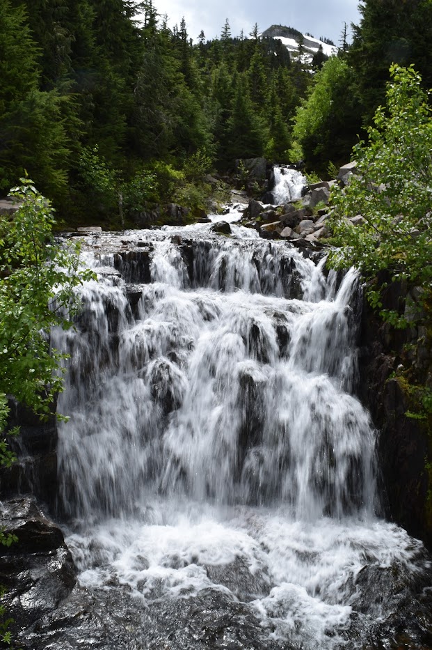
Upper Sunbeam Falls in July 2018

Near Upper Sunbeam Falls is another waterfall, Picture Frame Falls. As I mentioned in that post, these are both waterfalls that are of surprise waterfalls than waterfalls I planned to visit. As you’re driving along one of the main roads in Mount Rainier National Park, Stevens Canyon Road, you can stumble upon Upper Sunbeam Falls.

After looking up some information about this waterfall, I found that it is taller than it appears at about 75′. It’s not difficult to view, but it can be difficult to grasp that there are multiple drops, some of which aren’t as easily seen from the road. Even looking at the photo now, there must be some twists and turns to the overall falls here.

With many of the waterfalls (all?) in Mount Rainier National Park, they are best visited in the summer. There are a few that you might be able to visit in other months, but many of the roads can be closed outside of certain months. Even in July, it wasn’t “warm”, though it was comfortable.

Directions:

  1. If you are in Paradise, you would turn down Stevens Canyon Road and the falls will be about 2 miles from that turn (the intersection of Paradise Valley Road or Paradise Road). I don’t remember which side of the road the falls or parking were on.
  2. If you are coming from the east of the park, you will turn WA-123 onto Stevens Canyon Road.
  3. I would recommend checking the Mount Rainier page to see if you can drive into the park. You may be able to access the falls from WA-123, but access to Paradise is often unavailable until the weather is appropriate.

Accessibility: 10/10 (Easy)
Height: 75′
Length of Hike: roadside

Where in the World is Upper Sunbeam Falls?

Borrego Palm Canyon Falls, California

I’m not sure how I ended up visiting Anza-Borrego Desert State Park to look for waterfalls. There are a few waterfalls in the California deserts, and there is a small waterfall here. I think I looked in some book that mentioned a waterfall in the park, and I was in San Diego in late December, and figured I would head out to the park.

The cascade is found on the Borrego Palm Canyon Nature Trail, at least this one. The fascinating thing about the trail is that there are (or possibly were) some native California palm trees at the “end” of the trail. The California State Parks website mentions that access to the palms is currently closed, but that you can still hike the trail to an overlook to see how the palms are recovering from a wildfire. I don’t remember exactly where the falls were on the trail.

I wasn’t sure if this was the falls that I was supposed to find. It wasn’t a large waterfall, though there was definitely water “falling”. I recorded it anyway! The waterfall itself might not be the main attraction, but the canyon was very beautiful, and that was worth it. The hike is best done in the cooler months of the year due to extremely high temperatures in the summer months.

Directions:

  1. You may be approaching the state park from different directions, but you’ll be heading toward Borrego Springs. Borrego Springs is found on County Road S22.
  2. The park entrance is located near where S22 switches names from Montezuma Valley Road to Palm Canyon Drive.
  3. At that “intersection”, take a left. I believe you’ll notice the entrance to the state park pretty clearly from here.
  4. The visitor’s center comes first, but continue along to the campground and then to the trail head/parking area of the Borrego Palm Canyon Trail.
  5. The round-trip length of the hike is listed below, but I don’t remember whether I had to hike all that distance to see the falls. And it sounds like it’s currently shorter anyway because of the wildfire-affected areas.

Accessibility: 8/10 (easy/moderate)
Height: 6′
Length of Hike: 3 miles round-trip

Borrego Palm Canyon Falls in December 2013

Where in the World is Borrego Palm Canyon Falls?

Grace’s High Falls, Alabama

Grace’s High Falls in January 2016

Little River Canyon National Preserve in Alabama’s northeast corner is a really great place to visit for some amazing scenery and a number of waterfalls. I’ve posted about two already: the main attraction, Little River Falls, and a waterfall further downstream, Martha’s Falls. Both of those are on the Little River.

Grace’s High Falls is the third easily-viewed waterfall in the preserve, but it is not on the Little River. It’s not a waterfall that you hike to (though there may be a way?), but instead one that you view from the Little River Canyon Rim Parkway. Once the parkway reaches Bear Creek, it follows the creek for a way as the canyon is pretty deep there. At the Grace’s High Falls Overlook, you’re viewing the falls from across the creek. It provides a pretty good view and there’s parking also available.

Grace’s High Falls is seasonal. I visited in January 2016 and there was water flowing. In the summer, you may not see much water, so this is one that is best viewed in winter or spring.

Directions:

  1. The Little River Canyon Rim Parkway is found along AL-176. I believe I turned left on AL-176 from AL-35. Little River and Martha’s Falls are both nearer AL-35.
  2. From the other falls, if you stay on AL-35, it’s a bit over 7 miles from the other falls to the Grace’s High Falls Overlook. The parking area will be on the left if you were headed south-ish from AL-35.

Accessibility: 10/10 (easy)
Length of Hike: roadside
Height: 133′

Where in the World is Grace’s High Falls?

Chatham Falls, Michigan

Chatham Falls probably wouldn’t register as a waterfall of interest in certain areas. Even in Michigan, it doesn’t really register as a big, important, or interesting waterfall. So I guess it would be appropriate to wonder why I would write about the falls.

Alger County in Michigan’s Upper Peninsula has many spectacular waterfalls. Near the Lake Superior shoreline, there are a number of cliff formations that help to form these waterfalls and the Pictured Rocks. Further away, there are still a number of other waterfalls found along some larger creeks and rivers. Chatham Falls is really an odd duck. It’s in an area of Alger County that is relatively flat, and it’s somewhat surprising that there’s a waterfall there, but also that it’s not bigger. It’s a drop of about 1 meter/3 feet. I wouldn’t go out of my way to see Chatham Falls, but it’s honestly not that far out of the way. It’s a very short hike from Centennial Park off of MI-94.

Directions:

  1. Chatham is a village along MI-94. Head south along MI-94 from the center of Chatham.
  2. On the right after 0.8 miles from the center of Chatham, you’ll find Centennial Park, which may also be called Chatham Park.
  3. After parking, I feel like we headed toward a creek, possibly Bohemian Creek, which is on the north edge of the parks. We didn’t have to try hard to find the falls.

Accessibility: 10/10 (easy)
Height: 3′
Length of Hike: 0.1 miles round-trip

Chatham Falls in August 2017

Where in the World is Chatham Falls?