I had the chance to visit Indiana this past weekend, and decided to try and find some lesser-known waterfalls in northern Indiana. It took a bit more searching, but I discovered there were three locations within very close proximity that each had waterfalls. And you can visit all of these locations and waterfalls in just a few hours.
The first location I stopped at was Kokiwanee Nature Preserve. (Other falls can be found in Salamonie State Forest and Hathaway Preserve at Ross Run.) It has three named waterfalls: Kissing Falls, Daisy Low Falls, and Frog Falls. I had a sense some of these waterfalls might be seasonal, but as I was driving to the preserve, I saw many farm fields that had pools of water…this was a good sign.
I decided to enter the preserve from the less advertised starting point: a boat launch off of Stone Road. After looking at a map, I realized this might be a quicker way to reach all 3 falls. And it is, especially for Kissing Falls. When you get out of the car at the end of the parking lot, there will be a faint trail at the forest edge. This leads very quickly to the falls. (There is another trail that seems to lead to the falls further down the parking lot, but a sign says to go this other trail at the end…so respect that request.)
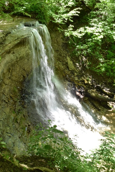
It was a short hike, about 0.1 miles one-way. As I followed the faint trail at the end of the parking lot, it quickly connects to a set of “stairs” (the ground has been groomed with pieces of wood to create these “stairs”). If you turn left and head uphill, you’ll again quickly see a sign that directs you to the waterfall trail. There’s a sign that says the hike is difficult, but I’m not really sure what they’re referring to. I guess if you head downhill and try to get to the base of the falls by hiking up the stream (if that’s allowed), it might be a bit more difficult. I wasn’t feeling particularly great, and decided to follow the trail that ran parallel to the creek. After a very short distance, I came to Kissing Falls (looking at it from above). I felt this was a fine enough view to take some shots and head to the other falls in the park. Because of recent rains, the falls were flowing pretty well, though I couldn’t avoid the afternoon sunshine.
Directions:
- This is an instance where there’s not an obvious starting point. You can approach from multiple directions. It’s in between Wabash and Huntington south of US-24.
- The official entrance to the park is off of E 50 S (GPS at 5825 E 50 S, Lagro, IN 46941). I instead went to the intersection of E 50 S and Stone Road, and went south on Stone Road, turned right onto the road that led to the Salamonie River Boat Launch (can’t remember if there was a more specific name).
- At the end of this road, there’s a parking area. The trail to the falls starts at the end of the parking area (read above).
Accessibility: 9/10 (easy, it was very muddy, so bring appropriate shoes)
Height: ~20′
Length of Hike: 0.2 miles round-trip
Where in the World is Kissing Falls?