Rustic Falls, Wyoming

Rustic Falls in June 2014

There are so many beautiful waterfalls in Yellowstone National Park, in addition to all of the other amazing scenery and geological features. I’m ready to go back again and explore more! It’s been about 10 years since I’ve visited, so maybe next year is the right time to return.

Some of the waterfalls in the park are very widely known, mainly the namesake Lower Yellowstone Falls and Upper Yellowstone Falls. They’re relatively easy to visit, as are many of the others. None of them required a long hike that I can remember. A number of them are roadside waterfalls, and Rustic Falls is one of those roadside stops that make it so worth it to visit the park.

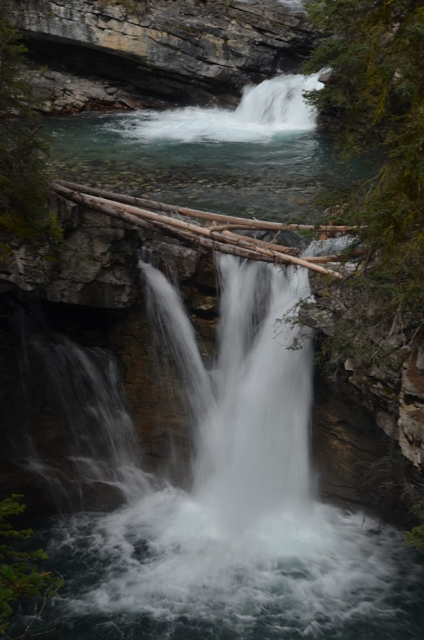
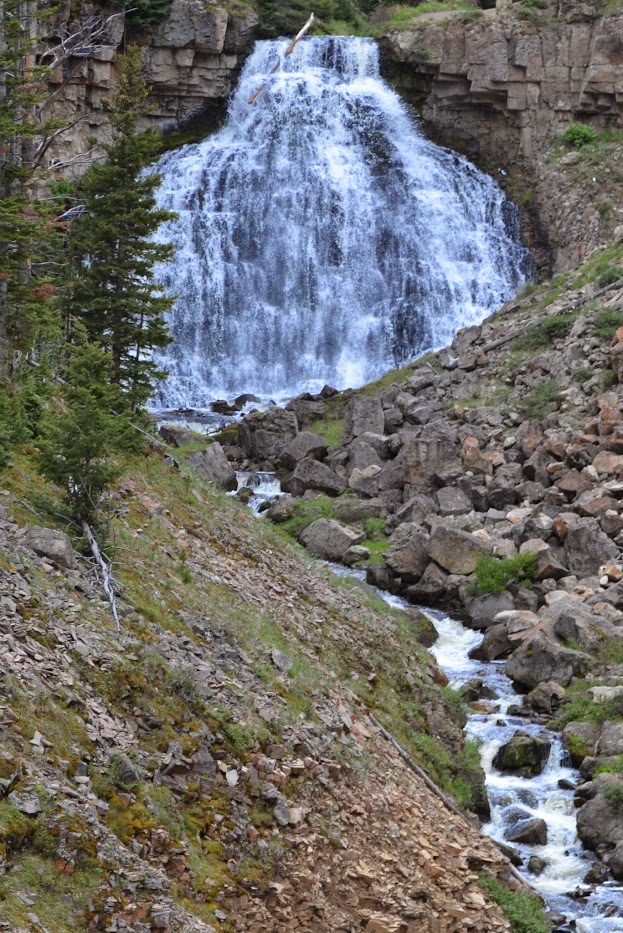
Rustic Falls is listed as being 47′ tall. That might be the top portion of the falls with some additional cascades below the falls. It’s a wider waterfall than some, so it seems like a bigger waterfall to me.

The best time to visit the park is in the summer months, at least for waterfalls and limited snow. Even when I visited in June 2014, it was rather cold and rainy, though the closer I got to Montana, the warmer it became.

Directions:

  1. There is a northern entrance to the park near the Montana/Wyoming border. The entrance is along US-89 and then heads into Mammoth. Mammoth is where you’ll find the Mammoth Hot Springs.
  2. To find Rustic Falls, you want to head south along US-89. About 5 miles south of Mammoth, you’ll find a parking area for the falls. If I remember correctly, there may be a sign but not much else. You’ll still have great views of the falls.

Accessibility: 10/10 (easy)
Height: 47′
Distance of Hike: roadside

Where in the World is Rustic Falls?

Tunnel Falls, Alberta

Tunnel Falls in August 2014

I’ve written about Johnston Canyon before, but I’ll reiterate this again…Johnston Canyon is really beautiful. You can find it in Banff National Park, and it’s really a worthwhile hike, even if you’re not interested in waterfalls. The canyon is really amazing and the water is so blue.

There are a number of distinct waterfalls that are large enough to be named in the canyon. I have six or so named falls. There are the Lower Johnston Canyon Falls, and then three interestingly named falls in between that and Upper Johnston Canyon Falls. Cavern Falls, Stella Falls, and Tunnel Falls are the three falls. Not that they’re wildly unique names, but I guess these three just needed more interesting names than Johnston Canyon Falls or something of that sort.

Tunnel Falls by itself would be a worthwhile waterfall to visit. With the other impressive waterfalls in the canyon, it’s a must see in my opinion.

Directions:

  1. This isn’t a particularly difficult set of waterfalls to find, with one minor hitch. The trail head is along of the Bow Valley Parkway (Highway 1A). If you’re driving along the Transcanadian Highway 1, there are limited entrances/connections onto 1A. In order to find the falls, you can either enter onto 1A a few miles after leaving Banff. You will be heading west if you take this exit, and the trail head will be on your right after driving for a while. (You can also exit at the junction of Transcanadian Highway 1 and Alberta 93. Instead of heading south, though, head north for a short distance. Then turn right and drive for 6.4 km. The parking area will be on your left.)
  2. I mention a parking area, but as I said, that parking area was completely full. There were at least a hundred or so cars (possibly more) parked on the sides of 1A, so that’s where I parked. It added a little bit longer to the walk, but it wasn’t much.

Accessibility: 8/10 (easy/moderate)
Height: 25′
Distance of Hike: 1.7 miles round trip

Where in the World is Tunnel Falls?

Undine Falls, Wyoming

Yellowstone National Park has a number of very impressive waterfalls within its boundaries. Most of them can be visited without much difficulty. Undine Falls is a roadside waterfall that requires minimal effort to view. Just pull off the road…I think there might be a designated pull-off/parking area, though many vehicles just pull off to the side of the road anyway to view wildlife. (There were damaging floods in 2022, so I’m assuming that the pull-off would still be there, though it may be damaged.)

Undine Falls in June 2014

There’s a loop that goes around…it could be described as two connected loops. Undine Falls is on the northern portion of the upper loop. It’s not that far from Mammoth Hot Springs. Wraith Falls is essentially right across the road. They’re separated by barely a mile in distance. Wraith Falls requires a hike, whereas Undine Falls doesn’t. I think this was the area where I saw a bear on a slope, and I only noticed because of the above mentioned cars that were pulled off to the side of the road!

Directions

  1. Mammoth Hot Springs and Fort Yellowstone are found along US-89. Those essentially represent the northern entrance to Yellowstone National Park.
  2. If you head east on Grand Loop Road, you’ll be headed toward Undine Falls.
  3. Undine Falls is about 4 miles east of the intersection of US-89 and Grand Loop Road. If you’re headed east, it will be on the left side of the road.

Accessibility: 10/10 (easy)
Height: 100′
Distance of Hike: roadside

Where in the World is Undine Falls?

Picture Frame Falls, Washington

In Mount Rainier, there is no lack of waterfalls. Some are very impressive, and then there are a few that you will stumble upon since there are so many sources of water. Picture Frame Falls is in the second category. It was not a waterfall I was looking for, but instead noticed it when driving by to some other falls.

Picture Frame Falls in July 2018

Stevens Canyon Road passes by a number of these falls. Ruby Falls is near the start of the road in Paradise. I missed that one on the map…cell service is nonexistent in the area, as is completely understandable. Upper Sunbeam Falls is a waterfall that can be viewed from the road. And then you can find Picture Frame Falls. You might be able to see Martha Falls, from the road, but that was another waterfall I was unaware of.

Picture Frame Falls is on Stevens Creek, and you can find a pull-off for parking by looking for a sign for Stevens Creek. I walked across the road to get a better view of the falls. The falls were somewhat blocked by vegetation, but even then they’re not significantly tall, though in another state with fewer waterfalls, Picture Frame Falls would be exciting!

Directions:

  1. If you are in Paradise, you would turn down Stevens Canyon Road and the falls will be about 4.5 miles from that turn (the intersection of Paradise Valley Road or Paradise Road). The falls will be on your left, but the parking are will be on your right.
  2. If you are coming from the east of the park, you will turn WA-123 onto Stevens Canyon Road and then the falls would be on the right, but the parking area will be on the left.
  3. I would recommend checking the Mount Rainier page to see if you can drive into the park. You may be able to access the falls from WA-123, but access to Paradise is often unavailable until the weather is appropriate.

Accessibility: 10/10 (Easy)
Height: 26′
Length of Hike: roadside

Where in the World is Picture Frame Falls?

Dickson Falls, New Brunswick

Fundy National Park is known for the big changes in the sea level due to the tides, but it also has other attractions that are very interesting. Third Vault Falls is THE waterfall to visit in the park, but it is a strenuous hike, in my opinion.

Dickson Falls in May 2016

If you’re looking for something less exhausting, Dickson Falls may be the waterfall/attraction for you. Dickson Falls is about half the height of Third Vault Falls, though Dickson Falls doesn’t seem as imposing. The hike, though, is under 1 mile round-trip. It was a rather easy hike. There are boardwalks and stairs built into the hike, and this allows for many different views of the falls. It’s definitely worth a stop if you’re in the park.

Directions:

  1. NB-114 forms a horseshoe that diverges from Transcanadian Highway 1 near Four Corners/Sussex and then loops back into Moncton. NB-114 passes through Fundy National Park.
  2. I came from Moncton, so was heading south/west on NB-114. You’ll reach Alma and then cross the Upper Salmon River into Fundy National Park.
  3. If you continue along NB-114, that will lead to the trail for Third Vault Falls. Instead, turn left onto Point Wolfe Road.
  4. Drive about 1.5 miles to the Dickson Falls Trailhead and start the hike to the falls.

Accessibility: 9/10 (easy)
Height: 26′
Length of Hike: 0.9 miles round-trip

Where in the World is Dickson Falls?

Kepler Cascades, Wyoming

There are so many wonderful waterfalls in Yellowstone National Park. With the geysers, geothermal features, and wildlife, it’s understandable why it’s such an amazing place! I visited in June 2014, and while the roads were clear of snow, it was still pretty chilly. One of the days it rained constantly and I wasn’t going to waste my time, so I did everything in the chilly rain. I was soaked when I got back to my cabin.

Kepler Cascades in June 2014

Kepler Cascades is one of the less visited waterfalls. It’s rather close to Old Faithful and the lodges, so it’s an easy stop if you’re visiting Old Faithful, which you should! There’s no hike required to view the falls. They’ve set up a viewing area. So don’t miss the Kepler Cascades when you visit Yellowstone National Park.

Directions:

  1. As I mentioned, Kepler Cascades is near Old Faithful and the lodges. Old Faithful is off of US-191.
  2. Drive just a bit further south on US-191 from the Old Faithful Lodge and on your right, you’ll find a parking and viewing area for the Kepler Cascades and the Lone Star Trailhead. There isn’t any hike required.

Accessibility: 10/10 (easy)
Height: ~50′
Length of Hike: negligible

Where in the World is Kepler Cascades?

Natural Bridge Falls, British Columbia

Wapta Falls and Takakkaw Falls are the more popular and impressive waterfalls in Yoho National Park. Natural Bridge Falls might not even be a stop, except that the Natural Bridge is the main feature that brings visitors to this spot. The waterfall might be considered secondary, though it created the feature!

The Natural Bridge is a rock/stone feature that has been created by the flowing water. While I don’t think the bridge is continuous, enough stone exists that it still looks like a bridge. The waterfall is larger than it might appear, being about 15′ tall. Much of the drop is hidden behind where the two large pieces of the bridge almost meet. I remember trying to get a good picture of the drop, but I don’t think there was any easy way to get to the angle necessary to capture the falls.

This stop was busier than some of the waterfalls that require a hike. It is an easy stop right off of Trans-Canadian Highway 1. If you continue on this road after exiting the highway, you’ll find Hamilton Falls.

Directions:

  1. From Trans-Canadian Highway 1 near Field, there will be a turn onto Emerald Lake Road. If you’re headed west, it would be a right turn.
  2. Once on Emerald Lake Road, after about 1.5 miles, you’ll find the parking area for the Natural Bridge.

Accessibility: 10/10 (easy)
Height: ~15′
Length of Hike: no hike required

The Natural Bridge in September 2014
Trying to get a better view of the falls behind the Natural Bridge

Where in the World is Natural Bridge Falls?

The Sinks, Tennessee

I haven’t posted in a while, and need to start posting more. I am hoping to be able to visit more waterfalls this summer. I haven’t seen many waterfalls in the past few years, partly due to surgeries, partly due to Covid, partly due to laziness!

It’s wild to think that I visited The Sinks six years ago this month! I took a weekend trip into Knoxville, Tennessee, and headed into Great Smoky Mountain National Park. Little River Gorge Road has many waterfalls that are very easy to view from the road, some of them I didn’t even expect to find! I think when looking at the map recently, there were others I could have visited in a short amount of time. Whiteoak Flats Branch Falls and Meigs Falls are both nearby.

Even in February, the drive was beautiful. The weather may have been unseasonably warm, as I remember when I left Michigan, it was very warm for a February day. In Tennessee, I believe that was also the case. Some of the waterfalls on this road don’t have designated parking areas…you just pull onto the side of the road. With The Sinks, there is a designated parking area and there are some trails that start from there. While The Sinks isn’t a tall waterfall, it’s definitely a good stop in an area with many waterfalls.

Directions:

  1. I took US-321 from Knoxville into the park. Once you’re on the Lamar Alexander Parkway, it’s pretty difficult to miss the entrance. There are signs everywhere!
  2. After entering the park, about a mile or so in, you’ll have a choice to take a right toward Cades Cove (which will lead to a number of waterfalls, including Abrams Falls) or a left toward the other park entrance and Gaitlinburg.
  3. Take a left, and drive about 5 miles along the beautiful winding, curvy road, and you will notice a parking area for the Sinks on your right.

Accessibility: 10/10 (easy)
Height: 30′
Length of Hike: roadside

The Sinks in February 2016

Where in the World is The Sinks?

Lower White Oak Canyon Falls #3, Virginia

DSC_0219

Lower White Oak Canyon Falls #3 in December 2011

In December 2011, I had a chance to visit Shenandoah National Park, and I decided to do the hike to see the waterfalls of White Oak Canyon. I’m not sure why I chose this specific trail, but I believe I knew it had a number of waterfalls along the trail.

I discovered while hiking that there were more waterfalls than expected, though I always wonder whether to count all of the drops along a creek/river as just one waterfall, or how to decide what counts as a separate drop. I decided that there were 5 interesting drops in the canyon, which you can easily find by looking for the correct category tag. I also found that there were 2 “side-falls”, which were waterfalls that were not on the main creek/river, but instead flowed into them. It was an interesting hike, but you should realize that it’s also a strenuous hike, depending on how far you go. I went a pretty good distance (almost 5 miles round-trip), but that also includes a significant elevation decrease on the way down, followed by a significant elevation increase on the way up. It will definitely give you a good workout, but make sure to bring water!

Directions:

  1. At the intersection of US-211 and Skyline Drive, head south on Skyline Drive.
  2. After five or six miles, you should see the parking area for the White Oak Canyon Trail, which is where your journey begins. It’s just after the entrance to the Skyland Resort.
  3. From here, follow the very clear signage for about 2.5 miles to the first falls. After the first lower falls, this is the next in succession. Be aware: the further downhill you progress, the longer the uphill climb you have. The uphill climb is where the difficulty lies.

Accessibility: 2/10 (strenuous)
Height: 10′
Length of Hike: 4.6 miles round-trip

Where in the World is Lower White Oak Canyon Falls #3?

Tom Branch Falls, North Carolina

Toms Branch Falls (25)

Tom Branch Falls in March 2017

Just inside the boundary of Great Smoky Mountains National Park in Bryson City, North Carolina are three waterfalls that can be seen in a not-so-difficult hike. Tom Branch Falls, Juney Whank Falls, and Indian Creek Falls can be found by starting at the Deep Creek Trail head. I think the trail continues on, but you can see all three falls within a 2 mile or so hike.

Tom Branch Falls is the first waterfall you’ll encounter, and you don’t have to hike the whole 2 miles to see Tom Branch Falls. The hike to Tom Branch Falls is only about 1/4 of a mile one-way, and the elevation gain is minimal. I remember the trail being rather flat up until this point. It does then change more in elevation to see the other two falls. I think I showed up when there wasn’t as much water flowing over Tom Branch Falls, so the other two falls were more exciting, even though they required a longer hike to view.

Directions:

  1. There isn’t one specific set of directions that will get you to the falls. It all depends on where you start. So head toward Bryson City, which is not far from US-19 or US-74.
  2. Route 1337 (W Deep Creek Road) is the most direct way to lead to the trail head. It is off of 1336 (Old River Road), which is on the north side of the Tuckasegee River.
  3. Drive 2.5 miles along Route 1337, W Deep Creek Road. Pass a number of other parking areas, and park in the Deep Creek Trail head parking area.

Accessibility: 10/10 (easy)
Height: 80′
Length of Hike: 0.5 miles round-trip

Where in the World is Tom Branch Falls?