
Lower Canyon Falls is on the Sturgeon River, which I believe has numerous waterfalls spread out over a distance. Right off the highway at a roadside park, you can find this set of waterfalls, Canyon Falls, Lower Canyon Falls, and Middle Canyon Falls in between.
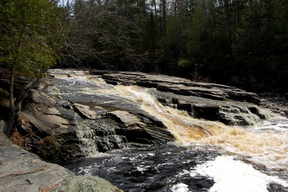
Compared to Canyon Falls, Lower Canyon Falls just isn’t as exciting. That might be because it’s hard to see the whole waterfall. If one could see the whole waterfall, part of which is hidden by rocks, you might find a complex waterfall. From certain angles, I could tell that there might be some very interesting drops. I don’t know if there’s a way to walk to these falls on the opposite side of the river. You’d have to check for private property, but if there is a way, you might want to check it out.
Directions:
- If you’re heading north on US-41 toward L’Anse and Baraga, the roadside park leading to Canyon Falls and the others will be on your left.
- Pull into the roadside area and park.
- The trail to the falls is very clearly labeled.
- As you walk along the trail, you’ll first pass some smaller drops, and then you’ll come to Canyon Falls.
- It might not appear like you can continue on, but continue on the trail to Lower Canyon Falls.
Accessibility: 7/10 (easy/moderate)
Height: 15′
Length of Hike: 1.6 miles round-trip
Where in the World is Lower Canyon Falls?

Leave a comment