
Quick Facts
Accessibility: 8/10 (easy/moderate)
Height: 20′ / 6 m
Length of Hike: 0.2 miles / 0.3 km round-trip
The Record
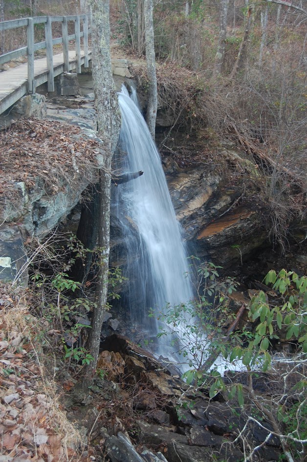
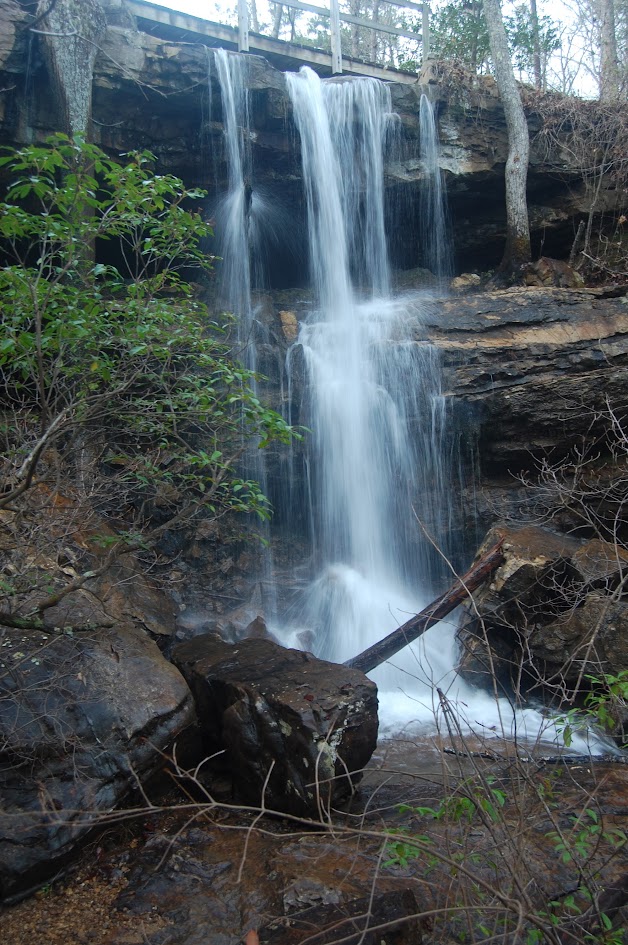
While DeSoto Falls might claim the fame and the height in DeSoto State Park, Indian Falls is a close runner-up heightwise. There are some cabins in the park, and hidden among them, you’ll find Indian Falls. At 20 feet tall, the water spills over a wide sandstone ledge.
The trail to the falls is short and relatively accessible. There are two options here (and I chose both!). You can view the falls from the trail, which requires a short hike on flat land. The second option requires a short, slightly rocky scramble down the hillside to the base. From the base, the waterfall looks different (wider?) from what might be expected from the trail. If I’m in northern Alabama, I’ll definitely visit Indian Falls again.
Directions
- From I-59, head toward DeSoto State Park. There are multiple ways to get there, and the way I took did not pass through Fort Payne. Other directions go through Fort Payne.
- Follow the signs to DeSoto State Park, as they’re pretty clearly placed along major intersections.
- You’re heading toward DeKalb County Road 89. You’ll drive for a while on this road until you enter the state park.
- From the direction I entered, I saw the gift shop first. I kept heading down County Road 89, and if I had kept going, I would have gone to Fort Payne.
- Locate the parking area for the Azalea Cascades Boardwalk (Blue Trail) and park here.
- Instead of heading toward the boardwalk, turn 180 degrees and look for the fenced-in sewage treatment plant. You’ll see a sign indicating Indian Falls.
- Cross the road and follow the arrows, which lead you directly to the waterfall. It’s pretty hard to miss.
- You’ll have to cross the creek, where you’ll then have to maneuver down the hill to get the best view of the falls.

Leave a comment