
Quick Facts
Accessibility: 6/10 (moderate, there are some uphill, rocky portions)
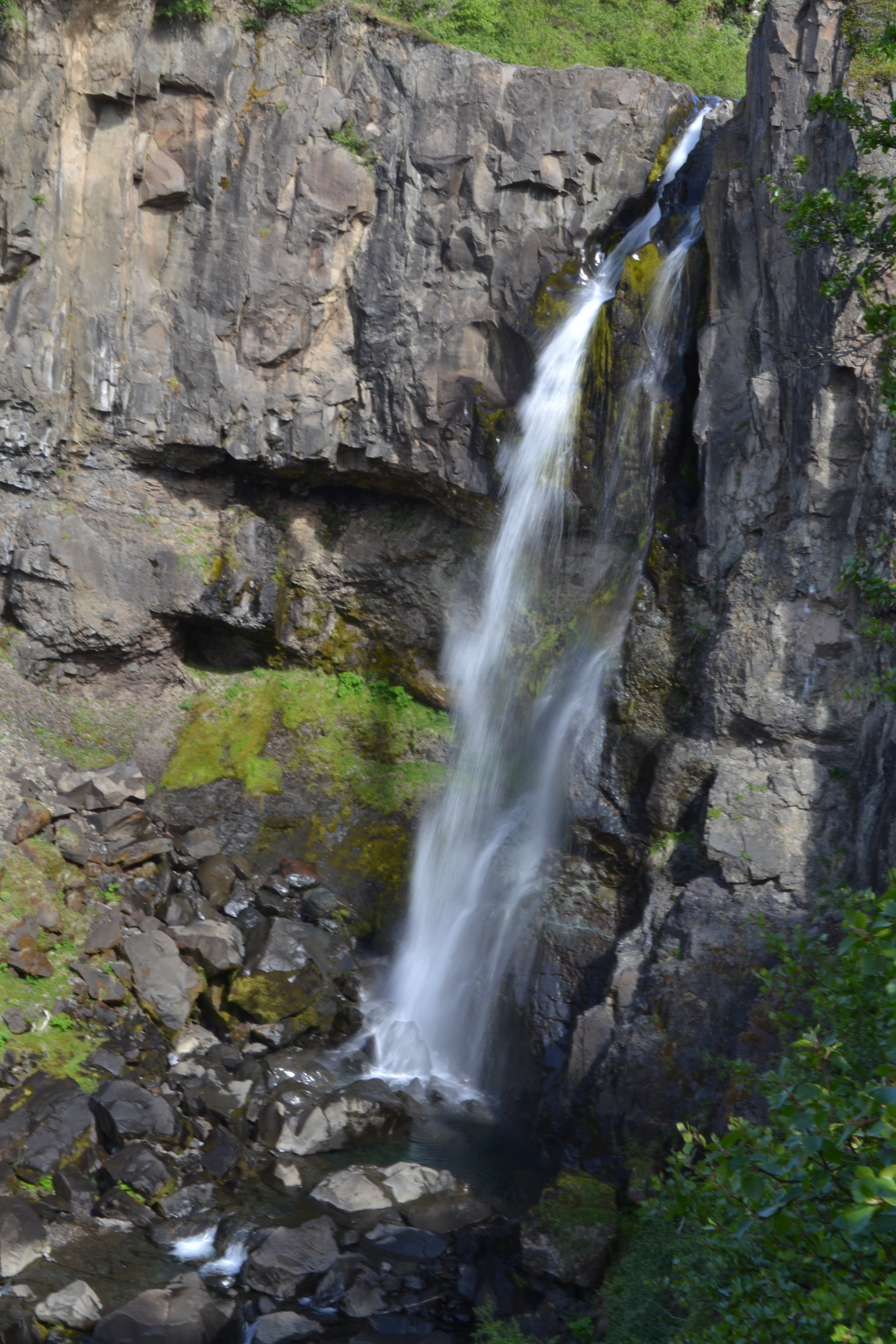
Height: 82′ / 25 m
Length of Hike: 1 mile / 1.6 km round-trip
The Record
If you’re looking for waterfalls in Iceland, the Ring Road is the best place to start. The Ring Road encircles the island, and many waterfalls are located only a short distance from the road. A significant number of these falls require little effort to visit.
Hundafoss does require a little more effort to visit, but not that much. It is found in Vatnajökull National Park, which is an expansive national park covering a significant portion of Eastern Iceland. In the southern portion of the park, you will come across Skaftafell, which is right off the Ring Road. From the visitor center at Skaftafell, you can take the right path to Skaftafelljökull, an impressive glacier. If you take the left path (which is not very obvious), you’ll be heading toward a set of waterfalls.
There are at least three easily visible waterfalls along this trail (Hundafoss, Magnúsarfoss, and Svartifoss), though I believe I’ve seen a fourth falls on other sites. I’m not sure where the fourth is, and I didn’t spend any time searching. The first waterfall you come across along the trail is Hundafoss. It’s more impressive than one might imagine. There is an “official” viewpoint for the falls near the crest, and that view is not particularly impressive. But if you pay attention as you’re hiking uphill, you’ll suddenly hear water flowing, and if you look to your left, you might notice a rather well-worn detour trail that very quickly leads to a pretty impressive view of the falls. You do have to duck under a few trees, but it’s well worth it.
Directions
- The entrance to the park is at Skaftafell, which is found directly off of the ring road. It is found east of Vík and west of Höfn. There are scheduled buses that will take you to the park directly from Reykjavík.
- If you’re heading east along the Ring Road, the entrance will be found on your left. Turn onto the road leading to the visitor center.
- Head to the visitor center, park, and get your bearings for a bit. To your right is the glacier. To your left is a path that leads to the set of falls.
- Head left on the trail. Signs will indicate the trail to Svartifoss, which is the most popular of the three falls.
- Head uphill for a bit, and you may begin to hear water flowing. Look for the unofficial trail to your left, and try and find the falls. (If you head a little further up the trail, and you see the sign indicating Hundafoss near its crest, you can backtrack a short distance to find this other short trail.)

Leave a comment