
Quick Facts
Accessibility: 4/10 (moderate/strenuous)
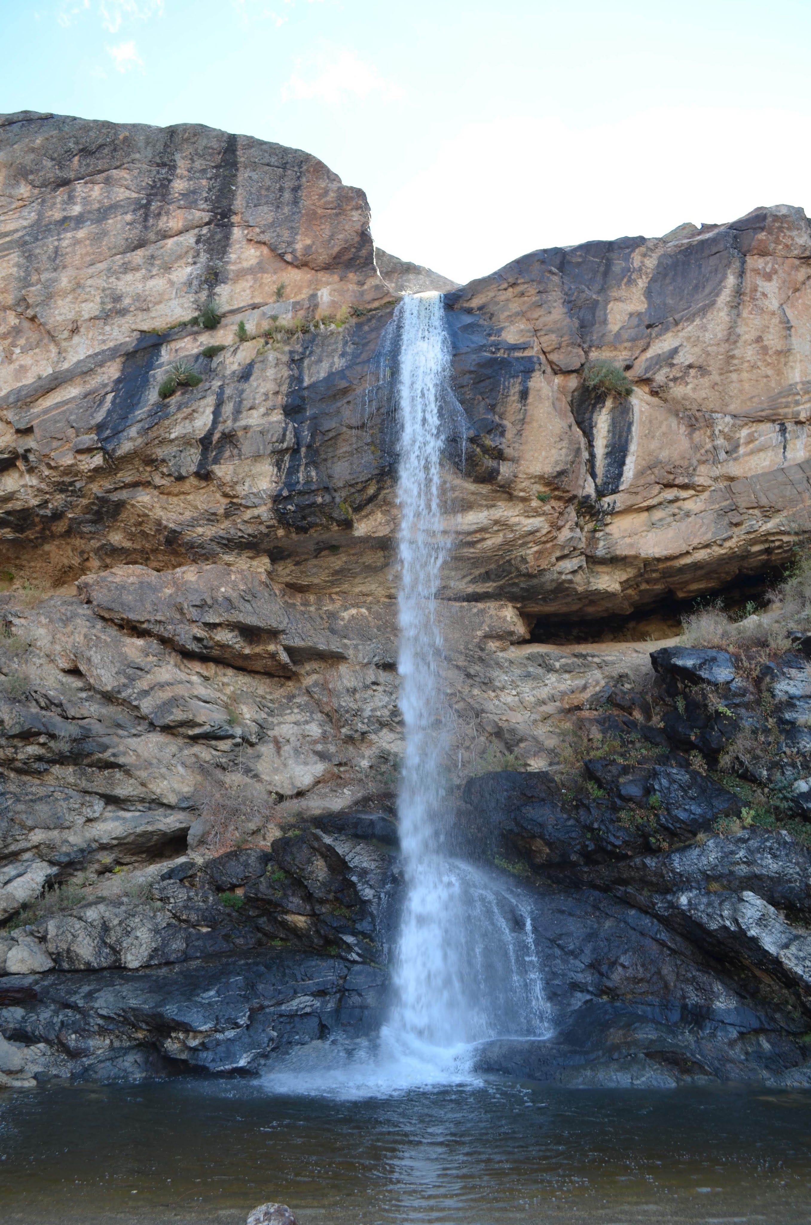
Height: 95′ / 29 m
Length of Hike: 7.4 miles / 11.9 km round-trip
The Record
When you think of Arizona, “waterfalls” probably isn’t the first word that comes to mind. It’s all desert, right? Surprisingly, there are far more hidden cascades here than you might expect, provided you catch them at the right time of year. My personal benchmark for Tucson hiking was established nearly five years ago during a trek to Seven Falls. That hike was long, winding, and, to be completely honest, rather unenjoyable. Determined to find a better experience upon my return to Tucson, I began scouting alternative options. While the nearby Tanque Verde Falls hike looked shorter but overly-complicated, the trek to Chiva Falls sounded much more approachable, despite its length.
Fortunately, the reality of Chiva Falls lived up to the promise. Clocking in at 7.4 miles round-trip, the distance does play a role, but the trail itself isn’t terribly difficult. The path features its fair share of ups and downs, but these are nicely moderated by long stretches of relatively flat terrain. At no point did I feel like I had signed up for voluntary torture. The ultimate reward is a beautiful, captivating view. I actually found it much more interesting than Seven Falls, though that might just be because I still had enough energy left to enjoy it!
If you decide to check it out for yourself, keep a few logistical notes in mind. This is a highly seasonal waterfall best viewed immediately after a good rain. My father and I timed our trek perfectly with a rainy Tucson morning. To get there, you’ll have to navigate Reddington Road. It’s rough, but still perfectly drivable in a smaller car. Because the trail doubles as a 4×4 and ATV route, you might be the only hiker on the path, but you are unlikely to be alone, so don’t expect total solitude. Finally, pay close attention to the signage. The route isn’t difficult to follow, but missing a marker will quickly complicate your day. My best advice? Once you get about two miles in, keep your eyes peeled and try to spot Chiva Falls from afar to help guide your way.
Directions
- In Tucson, drive along Tanque Verde Road until it becomes Reddington Road.
- Reddington Road turns into a dirt road after a certain point. Drive a little more than 4 miles along the road once it becomes DIRT. You will see a staging area on your left and a parking area (which can be difficult to see) on your right. If you pass mile marker 8, you have gone TOO far.
- Turn right into the parking area.
- Start along the trail connected to the parking area. The trail is very wide since it will also be used by all-terrain vehicles.
- Just keep following this trail for 2 miles or so. (Don’t think too hard for a while.)
- After 2 miles, you will see a large pond (shielded by wire fencing) on your left. At this point, look to your right for a faint hiking trail. Take this trail. (If you miss it, that’s fine…You can still also keep following the ATV trail, since you’ll rejoin it later. It’s just nice to have a trail to yourself for a while.)
- Follow this faint trail to the end of a very large cedar tree. Soon after this, you will reconnect to the wider trail.
- You will pass Trail 4405 on your right. Stay on the ATV trail.
- Soon after that, you will come to a “fork” in the road. Take the right trail, which was unsigned at that specific point. Do not take Trail 4426 (to your left).
- This right trail is 4405. Go downhill for a short distance, and you’ll come to an open space (which might be a wash with water at certain times). Keep to the far right, following the main ATV trail. If in doubt, you should see a sign (pointed toward you) for 4405.
- Keep walking on 4405 until you come to 4405A. Take a left onto 4405A, which heads downhill.
- At the end of 4405A are the falls!

Leave a comment