Skip to content
Waterfall Record
The Waterfall Record
Menu
Close
About Me
Australia
New South Wales
Queensland
South Australia
Victoria
Canada
Alberta
British Columbia
New Brunswick
Nova Scotia
Ontario
Québec
Croatia
France
Grenada
Iceland
Ireland
Japan
Mexico
Morocco
New Zealand
North Island (Te Ika-a-Māui)
South Island (Te Waipounamu)
Norway
Perú
Portugal
Azores
Flores
São Miguel
Madeira
Mainland Portugal
Puerto Rico
Slovenia
Spain
St. Vincent
Türkiye
United Kingdom
Northern Ireland
Wales
United States
Alabama to Florida
Alabama
Alaska
Arizona
Arkansas
California
Colorado
Connecticut
Florida
Georgia to Louisiana
Georgia
Hawaii
Hawaii (Big Island)
Kauai
Maui
Oahu
Idaho
Illinois
Indiana
Iowa
Kansas
Kentucky
Maine to Montana
Maine
Maryland
Massachusetts
Michigan
Minnesota
Mississippi
Missouri
Montana
Nebraska to North Dakota
Nebraska
Nevada
New Hampshire
New Jersey
New Mexico
New York
North Carolina
Ohio to Texas
Ohio
Oklahoma
Oregon
Pennsylvania
South Dakota
South Carolina
Tennessee
Texas
Utah to Wyoming
Utah
Vermont
Virginia
Washington
West Virginia
Wisconsin
Wyoming
Tag:
United Kingdom
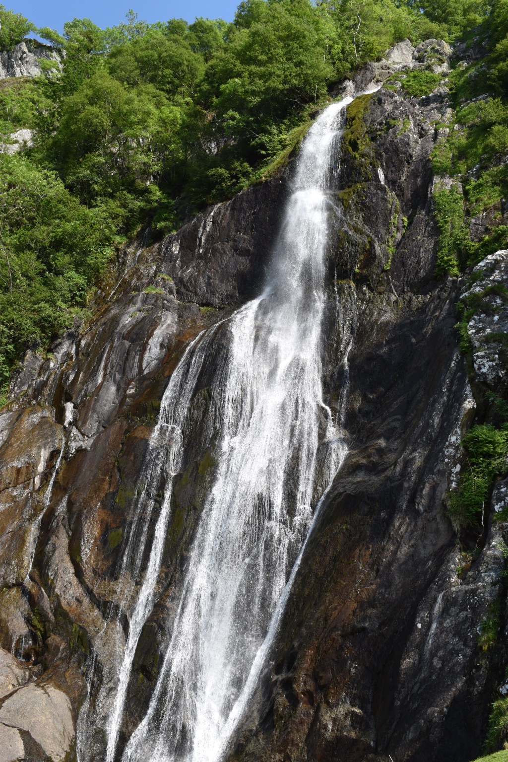
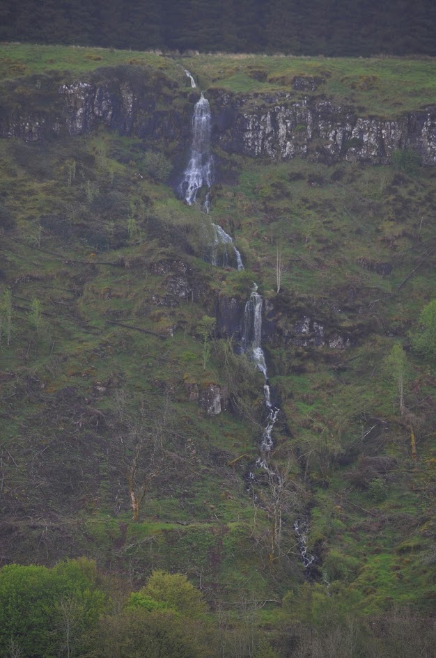
Aber Falls (Rhaeadr Fawr), Wales
Gwynedd County
.
United Kingdom
.
Wales
Aug 10.2025
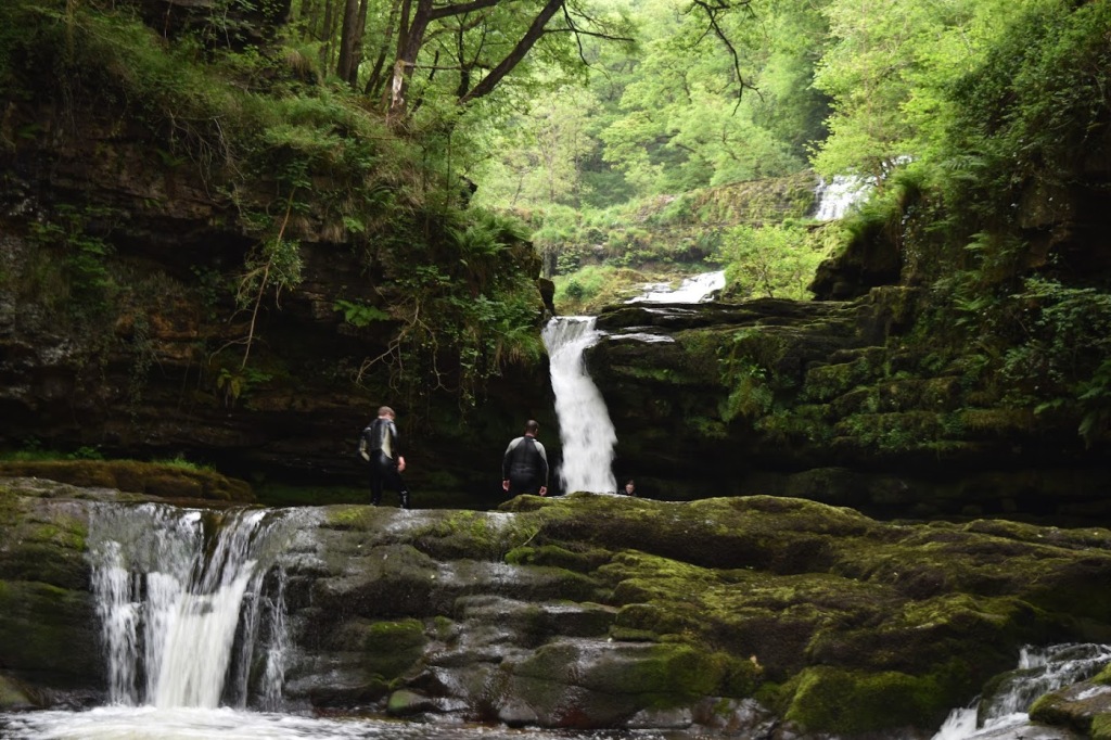
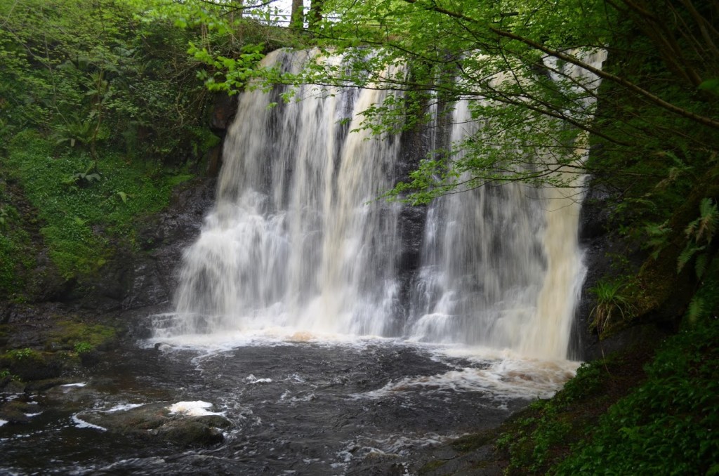
Sgwd Isaf Clun-Gwyn (Lower Fall of the White Meadow), Wales
Brecon Beacons National Park
.
Powys County
.
United Kingdom
.
Wales
Jul 17.2023
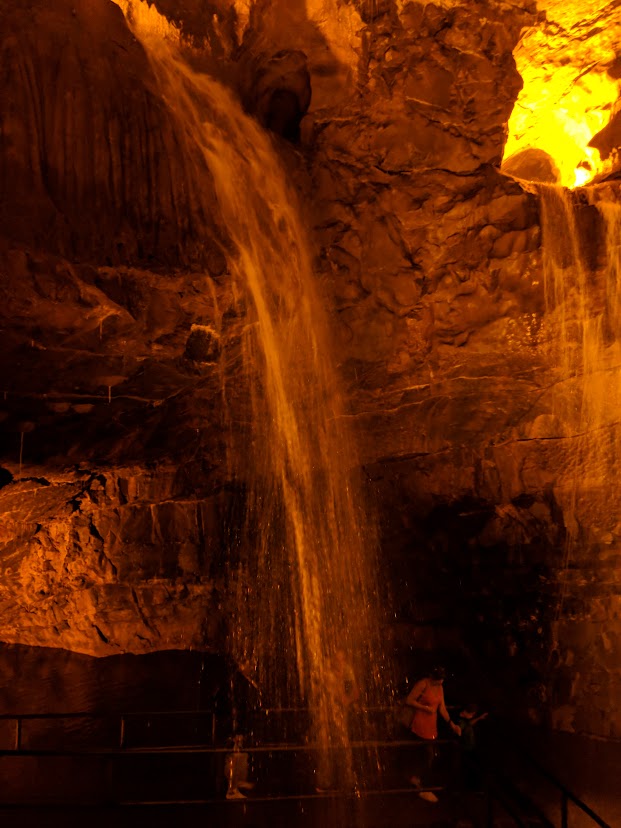
Dan yr Ogof Showcaves Waterfalls, Wales
Powys County
.
United Kingdom
.
Wales
Jul 17.2022
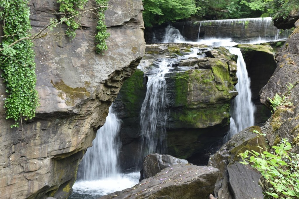
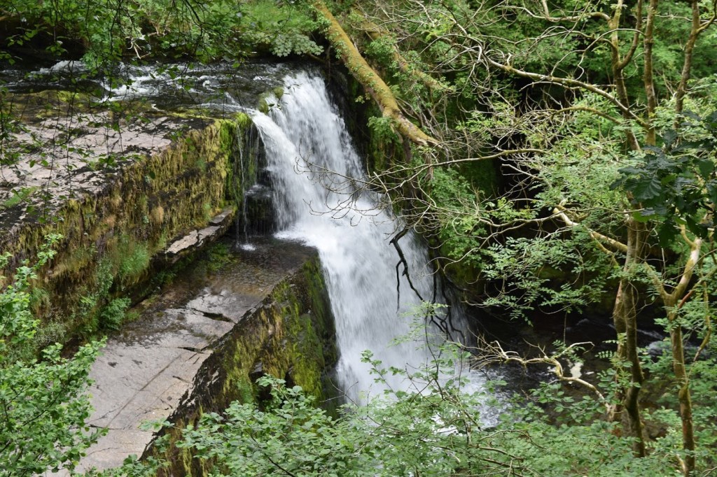
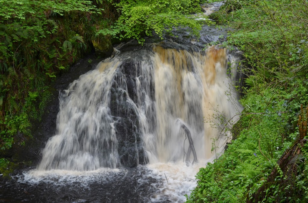
Aberdulais Falls, Wales
Neath Port Talbot County
.
United Kingdom
.
Wales
May 3.2022
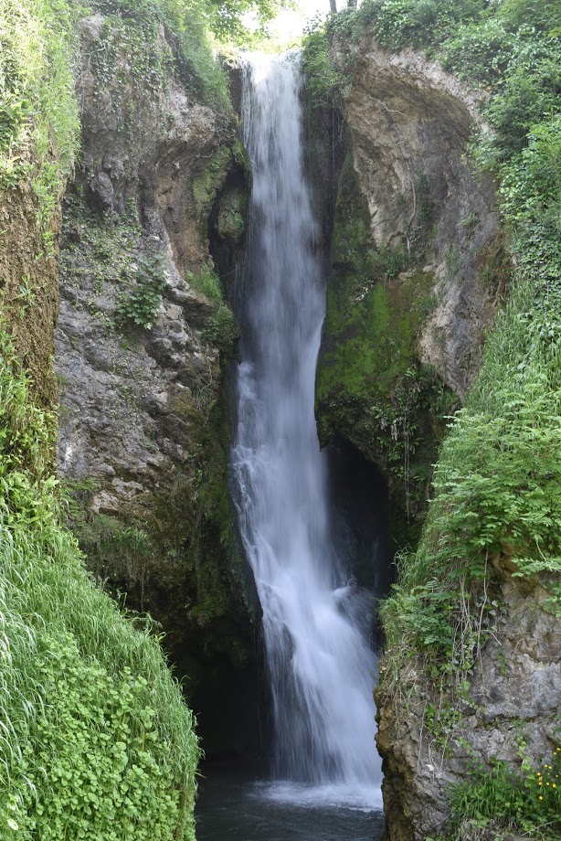
Ess-Na-Crub Falls, Northern Ireland
County Moyle
.
Glenariff Forest Park
.
Northern Ireland
.
United Kingdom
Jul 16.2019
Rhaeadr Dyserth (Dyserth Waterfall), Wales
Denbighshire County
.
United Kingdom
.
Wales
Jun 16.2019
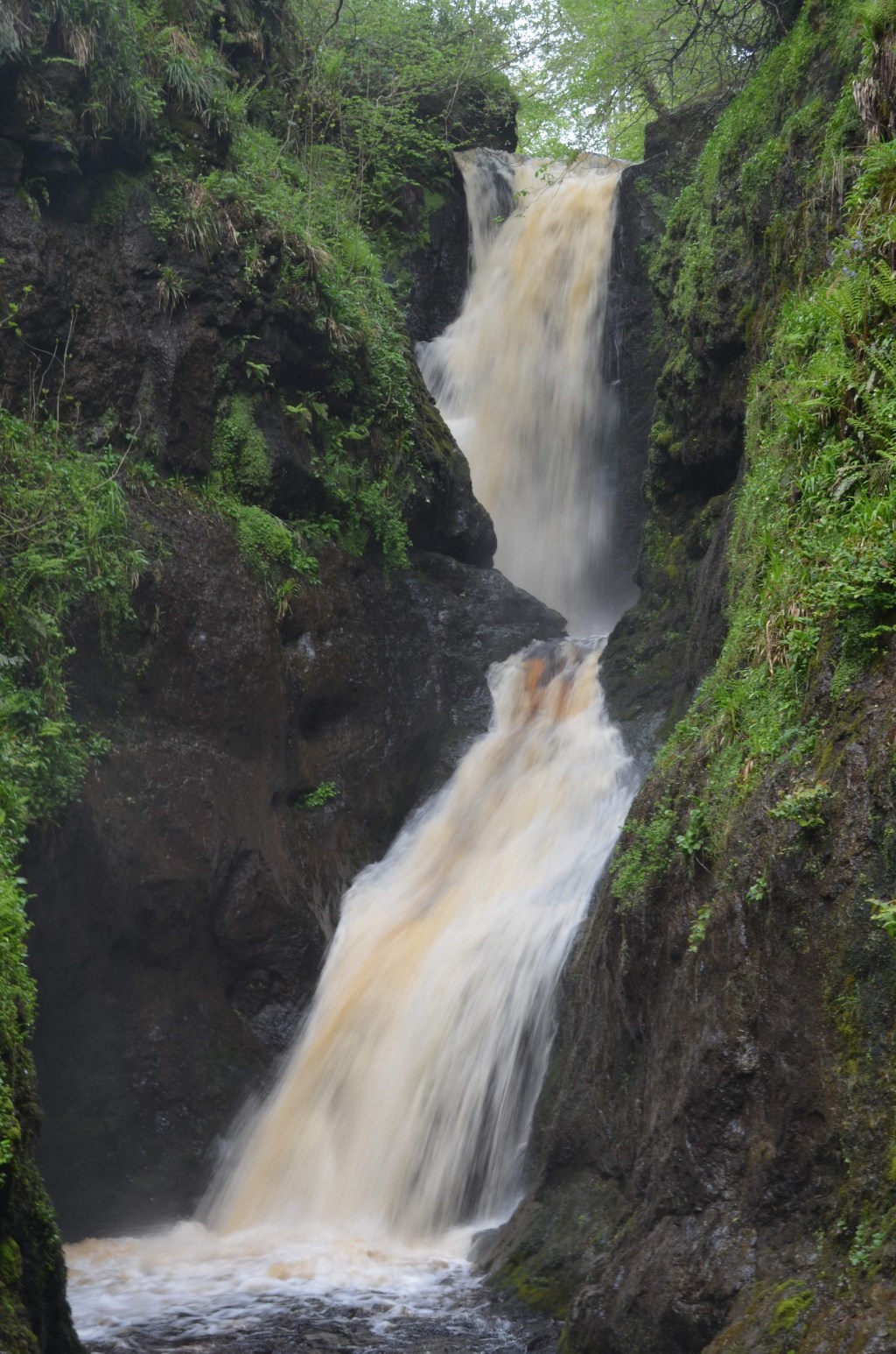
Sgwd Clun Gwyn (Fall of the White Meadow), Wales
Brecon Beacons National Park
.
Powys County
.
United Kingdom
.
Wales
Jun 12.2018
Ess-Na-Larach Falls, Northern Ireland
County Moyle
.
Glenariff Forest Park
.
Northern Ireland
.
United Kingdom
May 23.2018
Waterfall near Glenariff Forest Park, Northern Ireland
County Moyle
.
Glenariff Forest Park
.
Northern Ireland
.
United Kingdom
Jul 27.2014
Waterfall in Glenariff Forest Park, Northern Ireland
County Moyle
.
Glenariff Forest Park
.
Northern Ireland
.
United Kingdom
Jun 29.2014
1
2
Next Page
Subscribe
Subscribed
Waterfall Record
Join 375 other subscribers
Sign me up
Already have a WordPress.com account?
Log in now.
Waterfall Record
Subscribe
Subscribed
Sign up
Log in
Report this content
View site in Reader
Manage subscriptions
Collapse this bar